
The important role that hydrographic offices play in the development of marine, national and regional spatial data infrastructures is becoming clearer and more prominent. However, many lack the capability and capacity required to undertake this role. Realising this, in 2006 John Pepper, then of the UK Hydrographic Office, and Dr Mike Osborne, founder and then MD of SeaZone, approached the IHO on the potential for the IHO to assist Member States to engage in SDI development. In response, the IHO’s President, Admiral Maratos, requested a paper be written on the subject.
Recent amendments to the IHO’s constitution included the wider uses of hydrographic data beyond navigation and the paper should reflect these aims, he said. It was not surprising then that when the paper was submitted at the 4th Extraordinary International Hydrographic Conference (EIHC), Monaco in June 2007, it was given overwhelming support.
The result from the 4th EIHC was the setting up of the IHO Marine SDI Working Group, with representatives from hydrographic offices worldwide. The efforts of the group culminated in the publication of a Guidance Note of Marine SDI (IHO C-17) in 2009, downloadable from the IHO website. One of the strongest recommendations of the working group requested that the IHO supports improvements in understanding and capability of hydrographic offices in this emerging topic through its capacity building programme.
Other recommendations included that SDI become a standing item on the agendas of Regional Hydrographic Commissions and that the IHO forge links with like minded organisations, such as the European Commission and the Open Geospatial Consortium, involved in development of SDI. These recommendations were accepted and a programme of work, to be delivered via IHO Member States, put in place.
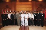
In March 2011, the EAHC Chairman’s Office contacted the authors of the original paper requesting that the first course in the capacity programme be held in Bangkok for students and observers from Korea, Philippines, Singapore, China, Japan, Indonesia, Vietnam, Malaysia and Thailand. Wishing to respond positively to the enthusiasm and commitment shown by EAHC, and with IHO support in place, the authors agreed. As well as the theoretical aspects of SDI, it was important to cover the practical elements of database design and management with hand on exercises. For this, the authors contacted Caris and Julien Barbeau was enlisted to help out. On Monday 24 June, Vice Admiral Prayuth Netrprapa, Director General of HDRTN, formally opened the course. The emphasis was on students to learn but to do it in an enjoyable manner.
Feedback from students and observers alike was that the course was excellent, with delegates having developed a good understanding of SDI development. With continuing support, there is a much better chance of the IHO’s general, and the MSDI Working Group’s specific aims being met through more effective data management, database design and organisational efficiency.
The authors wish to thank the EAHC and the HDRTN for their support and tremendous hard work leading up to and during the course, which contributed immensely to the course’s success.
—————————————————
OceanWise Limited is an independent company specialising in all aspects of marine environmental data acquisition, data and knowledge management and GIS. For more information, please contact John Pepper, Marketing Director, on [email protected] or visit the OceanWise website at www.oceanwise.eu.
CARIS solutions deliver cutting-edge bathymetric innovations, seamless feature data management, product extraction and distribution to support a diverse product range. For more information, please contact Andy Hoggarth or Matthew Holland, Marketing and Sales, on [email protected] or [email protected] or visit the Caris website at www.caris.com.
