Asian Surveying & Mapping
Breaking News
Australian Space Agency funds development of aerospace-grade GNSS receiver
The Australian Space Agency has funded the development of...
Continuity risks for Australian EO data access
A new report details the widespread use of Earth...
China launches new remote sensing satellite
JIUQUAN, April 15 (Xinhua) -- China on Monday launched...
7.4-Magnitude Earthquake Strikes Taiwan
A major, 7.4-magnitude earthquake struck the eastern coast of...
Tata Deploys Its Geospatial Satellite In Space on Space X’s Falcon 9 Rocket
THIRUVANANTHAPURAM: Tata Company launched India's first private commercial satellite...
Taiwan’s Formosat-8 Satellite Set for Launch by 2025
The Taiwan Space Agency has announced progress on the...
Iranian Scientists to Build Satellite Constellation for 2 Simultaneous Missions
The scientists at the knowledge-based company had previously succeeded...
China provides geospatial intel and other military support to Russia, US says
The US has warned its European allies that China...
Japanese lunar lander company ispace raises $53.5 million in stock sale
WASHINGTON — Japanese lunar lander developer has raised $53.5...
Esri and Prince Sultan University Advance GIS Education Through Strategic Partnership
Memorandum of Understanding with Institution Enhances GIS Curriculum and...
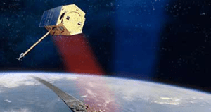
tandemx

The value of digital terrain models for mining, agriculture, hydrology and other terrain dependent work cannot be under estimated. While TanDEM-X will add valuable information into the marketplace, it is not the only data provider of high quality digital terrain models. Fugro, Intermap, Spot Image, GeoEye and others are similarly providing terrain model products.

Machine guidance systems are directly dependent upon high quality digital terrain models. Using GNSS these guidance systems not only locate positions in 2D (latitude and longitude or x, y)but they also connect the machinery operations to a 3D reference, which is greatly improved for accuracy depending upon the known terrain surface characteristics.

Other CAD based software used for building roads and infrastructure also connects to high quality digital terrain models.

It is expected that housing and architectural operations will come to include 3D terrain data more fully. This will lead to the inclusion of higher quality visualisation, animations and even better gaming software based on more realistic scenery in some cases.