Asian Surveying & Mapping
Breaking News
HAL to build, market Isro’s SSLV in landmark deal
New Delhi, Jun 20: In a historic move for...
Taiwan developing space capabilities for all-weather imaging
TAIPEI (TVBS News) — Taiwan is advancing its space...
Honda hails successful test of reusable rocket as it looks to get into the space business
Tokyo — Japan's second-biggest carmaker, Honda, has successfully tested...
China’s space program provides larger platform for broader international cooperation
BEIJING -- Experts from China's manned space program said...
India To Launch $1.5 Billion Joint Earth Mission With NASA In July
National Aeronautics and Space Administration (NASA) and the Indian...
Axiom-4 mission delayed again: ISRO confirms Subhanshu Shukla’s ISS spaceflight won’t launch before 22 June 2025
The Axiom-4 mission to the International Space Station has...
Mengzhou spacecraft for China’s moon-landing mission passes landmark test flight
China has completed the inaugural test flight of its...
Space application for ITMA Asia + CITME 2026 opens
Shanghai – Space application for the 2026 edition of...
Yanmar, Chia Tai and XAG Empower Thai Agriculture through Innovation
Bang Nam Priao District, Chachoengsao Province, Thailand – On...
bitsensing Signs MOU with IKIO Technologies to Advance AI-Based Traffic Monitoring on India’s Expressways, Highways and Municipal Areas
Backed by proven success in South Korea and Europe,...

Elevation

Thursday, January 12th, 2012

Geoimage Becomes a Reseller of Intermap Products in Australia

Geoimage is pleased to announce that it will be distributing NEXTMap products in Australia, Papua New Guinea, New Zealand and the Pacific countries after signing an agreement with Intermap Technologies.

Sunday, December 25th, 2011

Highly Accurate Elevation Data Worldwide

Whether planning an infrastructure network, conducting a military intervention mission in unknown terrains, or analysing terrain features for oil and gas exploration: accurate terrain height information is critical. Precise and reliable elevation data supports a wide range of...

Thursday, July 28th, 2011

Astrium Launches the GEO Elevation Product Suite

The GEO-Information division of Astrium Services is pleased to announce the launch of anew comprehensive offer of elevation data: the GEO Elevation product suite. These elevation models are used for high-quality image orthorectification, multi-scale mapping, terrain knowledge,...

Sunday, June 19th, 2011

OpenTopography v 3.2 Release Adds TIN-Based Gridding

The TIN (Triangulated Irregular Network) interpolation function now offered by OpenTopography uses Martin Isenburg’s high-performance code for generating raster digital elevation models (DEMs) from mass points via streaming Delaunay triangulation. A TIN model represents the landscape as...

Thursday, May 19th, 2011

Paper – GNSS Heighting and Its Potential Use in Malaysia

A system of vertical control is realised with the establishment of a levelling network whereby the height value of points may be defined. In early 1977, the Department of Survey and Mapping Malaysia (JUPEM) began to undertake...

Tuesday, May 10th, 2011

Quake Shifted Japan; Towns Now Flood at High Tide

The mostly devastated coastal communities now face regular flooding, because of their lower elevation and damage to sea walls from the massive tsunamis triggered by the quake. In port cities such as Onagawa and Kesennuma, the tide flows...
Friday, June 25th, 2010

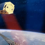
TanDEM-X Adds More Elevation Data

The TanDEM-X satellite was successfully launched recently. It is expected to provide a 12 m resolution digital elevation dataset for use around the globe. It marks yet another step in the...