

Tuesday, August 20th, 2024
The Ocean Exploration Trust (OET) Exploration Vessel (E/V) Nautilus set sail in August on its fifth expedition of 2024: E Mamana Ou Gataifale I (NA164). This expedition includes multi-vehicle exploration of midwater ecosystems across American Samoan waters. The midwater...
Tuesday, August 6th, 2024
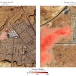
These images show the nitrogen dioxide plume column enhancements from two power plants in Saudi Arabia. Riyadh power plant 8 uses data based on the 60-meter Sentinel-2 UB band, while Riyadh power plant 9 uses data based...

Tuesday, July 23rd, 2024
An aerial view of Palmyra Atoll, where animal tracking data now being studied by NASA’s Internet of Animals project was collected using wildlife tags by partners at The Nature Conservancy, the U.S. Geological Survey, the National Oceanic...

Monday, July 8th, 2024
On July 3, 2024, the Japan Aerospace Exploration Agency (JAXA) advanced the Commercial Removal of Debris Demonstration (CRD2) Phase I project, under which the demonstration satellite Astroscale’s ADRAS-J successfully captured images of space debris, a non-cooperative target,...

Monday, June 24th, 2024
One of the images of the target space debris taken during the "fixed-point observation" (H-IIA upper stage, which launched Greenhouse Gases Observing Satellite (GOSAT), also known as Ibuki in 2009). The Japan Aerospace Exploration Agency (JAXA) advanced...

Friday, June 7th, 2024
The TRISHNA (Thermal Infra-Red Imaging Satellite for High-resolution Natural Resource Assessment) mission, a collaborative endeavor between ISRO and CNES, is engineered to deliver high spatial and high temporal resolution monitoring of Earth's surface temperature, emissivity, biophysical and radiation variables for surface energy...

Tuesday, May 28th, 2024
The island of Hawai’i and surrounding waters glow in unusual shades in this 2022 model made through NASA DEVELOP. The model was created to help the County of Hawai’i in their shoreline setback plan. The image shows...

Monday, May 13th, 2024
Ural River levels peak in this April 13, 2024, enhanced color image from Landsat 9; vegetation appears red, while water is blue-green. After heavy rain and rapid snowmelt, rivers in southern Russia and northern Kazakhstan swelled, flooding homes...
Monday, April 29th, 2024
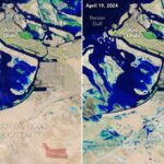
A slow-moving storm system pummeled the United Arab Emirates (UAE) and dropped more than a year’s worth of rain on some cities in April 2024. Heavy rain triggered flash flooding across eastern parts of the country, inundating...
Tuesday, April 16th, 2024
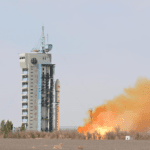
On April 15, 2024, China launched a Long March-2D carrier rocket, placing a remote-sensing satellite into space. The rocket blasted off from the Jiuquan Satellite Launch Center in northwest China and sent the Gaojing-3 01 satellite into...