Tuesday, December 17th, 2019
DAYTON, Ohio (Dec. 17, 2019) — Woolpert has been selected to perform aerial mapping and surveying via manned aircraft and unmanned aircraft systems (UAS) for two global mining operations under two separate contracts. The imagery is being...

Monday, December 16th, 2019
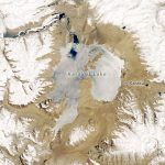
Karakul in many Turkish languages means “black lake.” That description of Karakul Lake, located high in the eastern Pamir Mountains in Tajikistan, is accurate for some of the year. But during the region’s frigid winter, the dark...
Monday, December 16th, 2019
Massachusetts – Aerial mapping company Bluesky International has launched a new 3D data capture programme in the US. The MetroVista product suite sees high resolution imagery, both vertical and oblique, captured simultaneously with high accuracy, wide scale...
Monday, December 16th, 2019
The call for speakers for GEO Business 2020 (20-21 May, Business Design Centre, London) is now open. Geospatial experts are invited to apply to speak at the event, which typically attracts over 3,000 professionals from across the...
Monday, December 16th, 2019
Hallowell, Maine — Blue Marble Geographics® is hosting a live webinar that will introduce the addition of photogrammetric point cloud processing from drone or UAV-captured images to the GIS software company’s free academic curriculum. The webinar is an...
Monday, December 16th, 2019
According to Indian Space Research Organisation (ISRO), the launch of PSLV-XL variant carrying Cartosat-3 and 13 US nano satellites has been rescheduled for November 27 at 9.28 am. Read More at Hindustan Times
Monday, December 16th, 2019
Trump tells North Korea‘s Kim Jong-un he‘s ‘acting very, very badly‘ after despot launches high-thrust rocket during US secretary of state‘s Asia visit despot Kim Jong-un is ‘acting very, very badly,‘ President Donald Trump said Sunday. Read...
Monday, December 16th, 2019
Aeronautics Group’s Orbiter 4 unmanned aerial system has completed a record-breaking 25 hour flight, setting a new endurance record for the company’s flagship platform. Read More at The Jerusulem Post
Friday, December 13th, 2019
LiDAR, short for light detection and ranging, is often considered the primary sensor for self-driving cars, given its ability to create high definition maps of the surrounding environment. LiDAR provides a three-dimensional point cloud of a car’s...
Friday, December 13th, 2019
SUNNYVALE, Calif. - Matterport, the market leader for spatial data capture, today made Measurement Mode available in Showcase, the company's web-based client for exploring its 3D spaces. The new functionality gives users the ability to share measurements taken...