Thursday, January 13th, 2011
Share your knowledge, experience and vision with over 1000 delegates by presenting a paper at the ISDE7, WALIS Forum 2011 and the State NRM Conference. We are now inviting submissions of abstracts for both oral and poster presentations....

Wednesday, January 12th, 2011
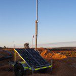
Mining fleet management specialists Leica Geosystems have launched their GPS Augmentation Network, incorporating exclusive technology developed by Locata Corporation.
Wednesday, January 12th, 2011
Thales will deploy its latest generation Eurocat ATM system nationwide, together with an integrated Digital Voice Control System (VSCS), Aeronautical Information System (AIS), Automated Message Handling System (AMHS), ATN Router, GNSS monitoring and metrological systems. In addition,...
Tuesday, January 11th, 2011
Intergraph has released the newest version of its enterprise viewing and markup software solution, SmartPlant Markup Plus. SmartPlant Markup Plus enables efficient and cost-effective precision view, markup and related capabilities for the many different types of engineering...

Tuesday, January 11th, 2011
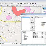
SMAP Technologies Inc. is an electronic map supplier, providing navigation system, LBS, Internet Map, and GIS projects for applications in various fields. Besides Taiwan, SMAP digital map database also includes Hong Kong, Macao, Singapore, etc.

Tuesday, January 11th, 2011
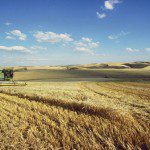
Aerial imagery and GNSS technologies are gaining popularity for use by agricultural producers. While precision farming has been a primary reason for introducing these technologies into many operations, other factors also play an important role - namely...
Tuesday, January 11th, 2011
SimActive a world-leading developer of photogrammetry software, is pleased to announce that GeoForce Technologies Co., Ltd. of Taiwan has purchased its Correlator3D™ product. GeoForce will be using the software suite in conjunction with its UltraCamXp camera system.
...Monday, January 10th, 2011
Geomatics technologies are able to support management and recovery in the aftermath of manmade and natural disasters. However, disaster management also poses big challenges in all aspects of the geo-information cycle, from data acquisition, processing, management and...
Monday, January 10th, 2011
The flooding of the Vaal river has caused considerable crop damages along its banks in three provinces, Water and Environmental Affairs Minister Edna Molewa said on Monday. "We have really been touched by the amount of devastation, particularly...