Asian Surveying & Mapping
Breaking News
Ecolab and ITE partners to harness water management knowledge for Singapore data center engineers
SINGAPORE, 29 APRIL 2024 – Nalco Water, an Ecolab...
NASA releases satellite photos of Dubai and Abu Dhabi before and after record flooding
NASA released photos of parts of Dubai and Abu...
Singapore releases 10-year Geospatial Master Plan
Singapore has launched its new Geospatial Master Plan (2024–33),...
Japan announces plans to launch upgraded observation satellites on new flagship rocket’s 3rd flight
TOKYO (AP) — Japan’s space agency announced Friday a...
Tesla China partners with Baidu for maps to clear FSD hurdle
Amidst Elon Musk’s unannounced trip to Beijing, China this...
ESA opens ideas factory to boost space innovation in Austria
A centre to innovate the design and manufacture of...
Japan’s space agency sets June 30 as third launch date for H3 rocket
The Japan Aerospace Exploration Agency (JAXA) announced Friday that...
S. Korea launches nanosatellite for Earth observation
SEOUL- A South Korean nanosatellite was launched into orbit...
Australian Space Agency funds development of aerospace-grade GNSS receiver
The Australian Space Agency has funded the development of...
Continuity risks for Australian EO data access
A new report details the widespread use of Earth...

Author Archive

image

Tuesday, December 21st, 2010

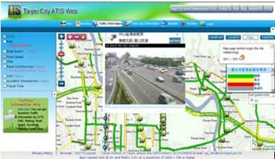
SuperGeo Awarded Geospatial Excellence Award at Geospatial World Forum 2011

SuperGeo Technologies, the leading global provider of complete GIS software and solutions, is honored to announce that it has won Geospatial Excellence Award by means of the application “Taipei City Advanced Traveler Information System (ATIS) Web”, structured...

Tuesday, December 21st, 2010

SuperGIS Server 3 Supports to Publish High-performance GIS Websites

SuperGeo Technologies, the leading global provider of complete GIS software and solutions, has released a white paper of SuperGIS Server 3 website performance testing report. In this white paper, the method and the procedure of the test...

Monday, December 20th, 2010

Optech Acquires Second Photogrammetric Camera Company

Optech Incorporated announced today that it has acquired the operations and assets of Geospatial Systems, Inc. (GSI), a United States camera and imaging company. “Photogrammetric imagery and lidar data collection technologies continue to merge into a single...

Monday, December 20th, 2010

NIWA Releases Review of NZ Temperature Trends

NIWA today released a report reviewing its seven station temperature series, which adds to its analysis of New Zealand’s temperature trends over the past 100 years. The report was independently peer reviewed by Australia’s Bureau of Meteorology to...

Monday, December 20th, 2010

Carlson Survey 2011 Embedded AutoCAD Just Released

Get the combined package of Carlson’s feature-rich, intuitive surveying office software with the AutoCAD® engine with Carlson Software’s just released Carlson Survey 2011 Embedded AutoCAD. The affordable Carlson Survey 2011 Embedded AutoCAD version comes with the AutoCAD...

Monday, December 20th, 2010

ERDAS 2011 Software – Available Now

ERDAS proudly announces the official release of ERDAS 2011 Software, including ERDAS IMAGINE, LPS, ERDAS APOLLO, ERDAS Extensions for ArcGIS 10 and other leading desktop and server products. Portfolio-wide changes for the ERDAS 2011 Software Release include the ability to...

Sunday, December 19th, 2010

Malaysia Approves Largest Infrastructure Project

The Malaysian Cabinet has approved the setting up of a mass rapid transit system for the country's capital Kuala Lumpur, Malaysian Prime Minister Najib Razak said Saturday. Najib said the 36-billion-ringgit (11.5-billion-U.S. dollars) project is the largest...

Saturday, December 18th, 2010

Address of the Incoming President – CheeHai Teo, FIG President 2011-2014

I am deeply humbled and honoured to wear this chain of office as I stand before all of you today. The immensity and weight of this responsibility are not loss on me. It is a responsibility and stewardship that...

Saturday, December 18th, 2010

FIG Handover Ceremony

The formal Handover Ceremony between the current and incoming FIG Councils and Commission chairs took place in Copenhagen 26 November 2010. At the Handover Ceremony President Stig Enemark gave the President's Chain of Office to the incoming President CheeHai...

Friday, December 17th, 2010

Azerbaijan – Conference Seminar of Navigation Committee of CIS Member States Council

Conference-seminar of Navigation Committee of CIS Member States Council of Geodesy, Cartography, Cadastre and Earth Remote Sensing took place with the support of companies Navgeokom of Russia and Leica Geosystems of Switzerland, November 22-26, Moscow. Azerbaijan was...

Page 171 of 178 1 166 167 168 169 170 171 172 173 174 175 176 178