Asian Surveying & Mapping
Breaking News
South Korea is converting an abandoned coal mine into a moon exploration testing ground
South Korea is transforming abandoned coal mines into testing...
ISRO to Launch Chandrayaan-5 With Japan, Plans Space Station
Dr. V. Narayanan, Chairman of the Indian Space Research...
Russia and China are threatening SpaceX’s Starlink satellite constellation, new report finds
SpaceX's Starlink satellite constellation is facing threats from Russia...
China and Pakistan agree to fly 1st foreign astronaut to Chinese space station
For the first time, the Chinese space program will train...
ISRO’s “Space on Wheels” offers a peek into Indian Space Programme to students in Karimnagar
The Indian Space Research Organisation (ISRO)’s “Space on Wheels”...
Geospatial led solutions build the foundations for better decision-making
Geo Connect Asia 2025 paves the way for turning...
GEOSA, Singapore Land Authority Launch Achievements of Joint Geospatial System Project
Riyadh, SPA -- The General Authority for Survey and...
Building in Bangkok collapses as powerful earthquake hits southeast Asia
One person has died and 50 were injured in...
Bellatrix Aerospace Partners with Astroscale Japan for Space Debris Removal
Bellatrix Aerospace, a Bengaluru-based space mobility company, has joined...
NSTC announces Pingtung site as Taiwan’s space mission launch center
Taipei, March 26 (CNA) Taiwan's National Science and Technology...

Author Archive

Wednesday, January 26th, 2011

STAR – Satellite Technology For The Asia-Pacific Region

The Satellite Technology for the Asia-Pacific Region (STAR) program is an international initiative to develop small satellites in collaboration with engineers and researchers from the Asia-Pacific region. STAR Program aims to 1) Provide opportunities to build capacity for Space...

Wednesday, January 26th, 2011

SuperPad 3 Supports Online Editing Services with SuperGIS Server

SuperGIS Server 3 is a set of map server software enabling enterprises to create, manage, integrate, and publish various GIS services in the centralized server architecture. For users who are in field survey, they can apply SuperPad...
Tuesday, January 25th, 2011

Singapore – Go-Ahead for Alignment of Northern Segment of North-South Expressway

The Government has given the approval for the alignment of the North-South Expressway (NSE) between Admiralty Road West and Toa Payoh Rise. As announced under the Land Transport Master Plan, the Government will be building NSE, a new...

Tuesday, January 25th, 2011

Chinese Surveying and Mapping in 2011 – Main Content of Work

Recently, the Sichuan Bureau of Surveying and Mapping Surveying and Mapping in 2011 published the main points of the province, asked the province to implement effective unit of survey and mapping industry.

Tuesday, January 25th, 2011

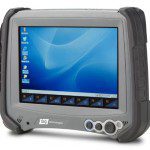
DAP Technologies Debuts New Windows CE 6.0 Rugged Tablet

Tablet innovator DAP Technologies today announced the availability of two new Windows CE 6.0-based rugged tablet computers. The voice-ready M8930 and M8940 models are the first tablets to incorporate breakthrough display technology that delivers maximum viewability in...

Tuesday, January 25th, 2011

Juniper Systems – Mesa Geo 3G Rugged Notepad

Juniper Systems is proud to announce that the Mesa Geo 3G Rugged Notepad is now available for shipment. In addition to all of the features available on the Mesa Geo model (Bluetooth® wireless technology, Wi-Fi®, GPS, and...

Tuesday, January 25th, 2011

STMicroelectronics – Single-Chip Multiple Global Navigation Systems

TMicroelectronics today introduced Teseo II, a new generation of single-chip stand-alone positioning receivers for Portable Navigation Devices, in-car navigation and telematics applications. These Systems-on-Chips are the industry's first monolithic devices capable of receiving signals from multiple satellite...

Tuesday, January 25th, 2011

3D Abu Dhabi Model to Be Set Up

A new project for setting up a 3-dimensional model of the Emirate of Abu Dhabi has been put into motion, announced the Municipality of Abu Dhabi City (ADM) on Monday in a statement. It is considered to...

Monday, January 24th, 2011

Country Sees Its First Wild Tiger Translocation

For the first time in Nepal, a wild tiger fitted with satellite collar was translocated from the Chitwan National Park (CNP) to Bardia National Park (BNP) today. CNP authorities had rescued the injured male tiger from the...

Saturday, January 22nd, 2011

Pointools Launches High-Value Point Cloud Software Bundle

Pointools has launched a new high-value software bundle for working with point clouds – the billions of measurement points collected by 3D laser scanners. This new “Pointools Suite” gives users a portfolio of applications and plugs-ins designed...

Page 161 of 178 1 156 157 158 159 160 161 162 163 164 165 166 178