Asian Surveying & Mapping
Breaking News
DIGIPIN Launched: India Embraces Geospatial Precision in Digital Addressing
IIT Hyderabad (IITH), in partnership with the Department of...
HAL to build, market Isro’s SSLV in landmark deal
New Delhi, Jun 20: In a historic move for...
Taiwan developing space capabilities for all-weather imaging
TAIPEI (TVBS News) — Taiwan is advancing its space...
Honda hails successful test of reusable rocket as it looks to get into the space business
Tokyo — Japan's second-biggest carmaker, Honda, has successfully tested...
China’s space program provides larger platform for broader international cooperation
BEIJING -- Experts from China's manned space program said...
India To Launch $1.5 Billion Joint Earth Mission With NASA In July
National Aeronautics and Space Administration (NASA) and the Indian...
Axiom-4 mission delayed again: ISRO confirms Subhanshu Shukla’s ISS spaceflight won’t launch before 22 June 2025
The Axiom-4 mission to the International Space Station has...
Mengzhou spacecraft for China’s moon-landing mission passes landmark test flight
China has completed the inaugural test flight of its...
Space application for ITMA Asia + CITME 2026 opens
Shanghai – Space application for the 2026 edition of...
Yanmar, Chia Tai and XAG Empower Thai Agriculture through Innovation
Bang Nam Priao District, Chachoengsao Province, Thailand – On...

Author Archive

Friday, January 28th, 2011

Gardline Geosurvey Extends Veripos Positioning Contract

VERIPOS has secured an extension to its contract with Gardline Geosurvey, for the provision of precise satellite positioning services. Under the general services agreement, VERIPOS will continue to supply its full range of GNSS positioning solutions to...

Friday, January 28th, 2011

Report: Seven Day Training Workshop On Geographic Information Science and Technology

The Geographic Information Science, also known as GI Science, is a newly emerging discipline of applied sciences. GI Science is concerned with the collection or capture of spatial data by such methods as satellite remotely sensed images,...

Thursday, January 27th, 2011

TeleNav Upgrades GPS Navigator

TeleNav has launched TeleNav GPS Navigator version 6.2 for select Android devices. The latest release is designed to deliver a faster and more reliable way to navigate, search, and view maps on a mobile device. New features...

Thursday, January 27th, 2011

3DSMART V2011 Released

In our continued efforts to provide the utmost in functionality, we've updated 3DSMART software to be compatible with AutoCAD 2011. This latest release is available for 32 and 64 bit versions of Windows 7, Vista and XP....

Thursday, January 27th, 2011

Scanpoint Geomatics Launches IGIS Software Version 1.1

Scanpoint Geomatics Ltd has announced that IGIS Package Developed by the Company with Technical "Know-how" from ISRO was launched on July 29, 2009 at Bangalore by the Chairman of ISRO. The Upgraded version of the software IGIS...

Thursday, January 27th, 2011

Japanese Aerospace Agency Selects Spirent for Multi-GNSS Testing

To further the development of the Quazi-Zenith Satellite System (QZSS) program, the Japanese Aerospace Exploration Agency (JAXA) has selected Spirent Communications’ testing solutions to verify performance of its satellite receivers. Responsible for the development of initial QZSS...

Thursday, January 27th, 2011

Matrox Mura MPX Series Add-In Boards Redefine Collaborative Video Walls

The new Mura MPX Series cards combine traditionally separate input and output cards onto a single-slot, PCI Express x16 Gen 2 board, leveraging 64 Gb/sec full duplex data transfer to display full frame rate, HD video input...
Thursday, January 27th, 2011

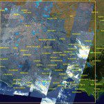
RapidEye Satellites Focus on Loddon Flood Waters, Victoria

The RapidEye constellation of five earth observation satellites have been focused on the East Coast of Australia, dedicating resources to capture valuable images of the ever- changing face of our flooding landscape. The readily enhanced RapidEye satellite...

Thursday, January 27th, 2011

GLONASS to Reach Cm Accuracy – General Designer

GLONASS constellation to be completed in 2011, to be enlarged with new-generation Glonass-K spacecraft, GLONASS General Designer, Russian Space Systems DG Yury Urlichich stated, quoted by Interfax.  Urlichich reminded that 24 spacecraft in 3 orbital planes at...

Wednesday, January 26th, 2011

Esri Technology Brings Geospatial Analysis to Windows Azure Marketplace

Esri announced today that Microsoft has selected ArcGIS as a foundation for viewing geospatial information within the DataMarket in Windows Azure Marketplace. Application developers and end users will be able to select the data they need in...

Page 160 of 178 1 155 156 157 158 159 160 161 162 163 164 165 178