Wednesday, March 16th, 2011
This article documents a current disaster. Information regarding it may change rapidly as it progresses. Although this article is updated frequently, it may not reflect the most current or official information about this disaster for all areas. Read More
Wednesday, March 16th, 2011
Sahana is a Free and Open Source Disaster Management system. It is a web based collaboration tool that addresses the common coordination problems during a disaster from finding missing people, managing aid, managing volunteers, tracking camps effectively...
Wednesday, March 16th, 2011
The Delhi cabinet Monday approved the draft Delhi Geospatial Data Infrastructure Bill, 2011 - a flagship project of the city government launched to frame and implement policies for issues relating to geospatial data. The bill, to be introduced...
Wednesday, March 16th, 2011
According to NEDA-Caraga regional director Carmencita S. Cochingco, as the socioeconomic planning agency of the region and the secretariat of the Regional Development Council (RDC), their office will spearhead the institutionalization of a geographic information system (GIS)...
Wednesday, March 16th, 2011
The objectives of the consultancy are in general to provide appropriate training, technical and project management support. The actual production work has to be done by NBS. The main goal is the empowerment...

Wednesday, March 16th, 2011
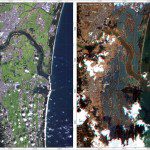
The images were acquired by the German Optical RapidEye and radar TerraSAR-X satellites. They show Torinoumi on the eastern coast of Japan before the disaster on 5 September 2010 and after the tsunami on 12 March 2011....

Wednesday, March 16th, 2011
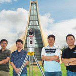
Linkfast Technology Co., Ltd., a Taiwan-based survey solutions provider of Geographical Information Systems (GIS) data, and a reseller of 3D laser scanning technology, has joined the Pointools Partner Program in Asia. Pointools software is used by project...
Wednesday, March 16th, 2011
International Journal of Geoinformatics will publish a special issue on Global Navigation Satellite System (GNSS) in September 2011. All the experts, academicians, and researchers working in the field of Global Positioning System (GPS), GLONASS, Galileo, QZSS, Beidou,...
Wednesday, March 16th, 2011
Kei Furuta, managing director of Equinix Japan says the company has arranged for priority deliveries of diesel fuel so that both data centers can continue running through the blackout periods that the local utility Tokyo Electric Power...
Wednesday, March 16th, 2011
Kyushu Institute of Technology (Kyutech), one of Japan’s top science and research universities, has selected Intergraph® SmartMarine 3D design and engineering software for use in its Department of Creative Informatics to use in shipbuilding design research.