Monday, March 21st, 2011
A shrill alarm goes off, a giant screen comes to life and an earthquake strikes—measuring 6.1 on the Richter scale in the Pacific islands of Vanuatu. At the Tsunami Early Warning Centre of the Indian National Centre...
Monday, March 21st, 2011
National Economic and Development Authority (NEDA) Caraga will launch its Regional Geographic Information System Center (RGISC) on March 22. The RGISC promotes Geographic Information System (GIS) as a tool for effective planning, decision-making, policy formulation, investment programming and...
Sunday, March 20th, 2011
Bathy DataBASE now works with Oracle Spatial 11g utilizing the GeoRaster and geo point cloud data structures for storage. Oracle Spatial has been specifically designed to meet the needs of advanced geographic information system applications and is...
Sunday, March 20th, 2011
Stakeholders and landowners present at the launch of the Fiji National REDD-plus policy were in a collective agreement that significant progress had been made towards the establishment of a national MRV (measuring, reporting, and verification) system. The two...
Sunday, March 20th, 2011
Trimble announced today that it partnered with Truecount Corporation, an innovator in RFID software solutions for the retail industry. Truecount will leverage ThingMagic enterprise-grade RFID readers to deliver best-in-class item-level RFID platforms for...
Sunday, March 20th, 2011
The Central Environmental Authority (CEA) has develop an environmental resource information data base for each district as environmental profile by using its expertise knowledge on remote sensing and spatial data bases. The data base will allow identifying spatial...
Sunday, March 20th, 2011
The Prime Minister today said a new government department could be set up to deal with rebuilding Christchurch. John Key said the Government was going to play a leading role because no city council in New Zealand had...

Saturday, March 19th, 2011
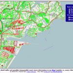
A dynamic map overlay showing the Road Status after the Earthquake in Sendai, Japan, based on the user generated maps from OpenStreetMap has been generated by Pascal Neis, member of the GIScience Research Group of the University...
Wednesday, March 16th, 2011
Trimble today announced that it has entered into a definitive agreement to acquire certain assets related to the OmniSTAR™ Global Navigation Satellite System...