Asian Surveying & Mapping
Breaking News
South Korea is converting an abandoned coal mine into a moon exploration testing ground
South Korea is transforming abandoned coal mines into testing...
ISRO to Launch Chandrayaan-5 With Japan, Plans Space Station
Dr. V. Narayanan, Chairman of the Indian Space Research...
Russia and China are threatening SpaceX’s Starlink satellite constellation, new report finds
SpaceX's Starlink satellite constellation is facing threats from Russia...
China and Pakistan agree to fly 1st foreign astronaut to Chinese space station
For the first time, the Chinese space program will train...
ISRO’s “Space on Wheels” offers a peek into Indian Space Programme to students in Karimnagar
The Indian Space Research Organisation (ISRO)’s “Space on Wheels”...
Geospatial led solutions build the foundations for better decision-making
Geo Connect Asia 2025 paves the way for turning...
GEOSA, Singapore Land Authority Launch Achievements of Joint Geospatial System Project
Riyadh, SPA -- The General Authority for Survey and...
Building in Bangkok collapses as powerful earthquake hits southeast Asia
One person has died and 50 were injured in...
Bellatrix Aerospace Partners with Astroscale Japan for Space Debris Removal
Bellatrix Aerospace, a Bengaluru-based space mobility company, has joined...
NSTC announces Pingtung site as Taiwan’s space mission launch center
Taipei, March 26 (CNA) Taiwan's National Science and Technology...

Author Archive

Thursday, March 24th, 2011

NZGO Builds National Geospatial Skills Database

On 3 March 2011, the New Zealand Geospatial Office offered to build a database of geospatial professionals who may be available to provide relief for the people based in Wellington and Christchurch who are ...
Thursday, March 24th, 2011

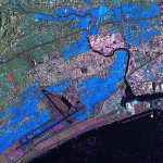
TerraSAR-X Satellite Data Reveals Destruction Caused by Tsunami in Japan

The German Remote Sensing Data Center (Deutsches Fernerkundungsdatenzentrum; DFD) and the German Space Operations Center (GSOC), both of which are part of the German Aerospace Center (Deutsches Zentrum für Luft- und Raumfahrt; DLR), are continuing to provide...

Tuesday, March 22nd, 2011

Hemisphere GPS Reports 2010 Q4 Year-End Results

Hemisphere GPS, a designer and manufacturer of advanced GPS products, today reported financial results for the fourth quarter and year ended December 31, 2010. All amounts in this news release are expressed in US dollars. For the fourth quarter...

Tuesday, March 22nd, 2011

NovAtel Inc. and Raven Industries Announce New Supplier Agreement

NovAtel Inc. and Raven Industries announce a new strategic partnership that will see NovAtel's industry leading Global Navigation Satellite System (GNSS) positioning technology integrated into Raven's comprehensive line of precision agriculture products. The convergence of these two...

Tuesday, March 22nd, 2011

Learning to Manage Disasters in Malaysia

An earthquake measuring 8.9 on the Richter scale followed by 10-meter high tsunami in Japan, last week managed to remove the perception of the international community since the beginning of this year's protest focused on the disaster...
Tuesday, March 22nd, 2011

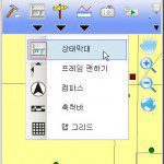
SuperPad 3 Now Supports Italian and Korean Languages

SuperGeo Technologies announced that SuperPad 3, the full-functioned mobile GIS software of SuperGIS 3 series products, now supports Italian and Korean languages. Possessing powerful and comprehensive GIS functions, which integrates the mapping, GIS and GPS functions...

Tuesday, March 22nd, 2011

Leica Geosystems Geomatics Division Becomes Esri Gold Tier Partner

Leica Geosystems announced today that it has become an Esri Gold Tier Partner within the Esri Partner Network. Leica Geosystems has developed a surveying extension for ArcGIS – called Leica MobileMatriX – with an interface to a...

Tuesday, March 22nd, 2011

Bringing Cultural Heritage to Life – FARO Laser Scanner

Art Graphique & Patrimoine, a specialist in dimensional drawings of buildings and works of art, uses the FARO Laser Scanner to create virtual mock-ups, which were then used to create spectacular enhanced reality applications. With the FARO Laser...

Monday, March 21st, 2011

Topcon Beijing (HK) Joins Pointools Sales Partner Program in Asia

Topcon Beijing (HK)  Ltd., a leading provider of 3D laser scanning technology, has joined the  Pointools Partner Program in Asia. Pointools software is used by project teams  to reference and reuse the largest point cloud models –...

Monday, March 21st, 2011

Simulation of the Tsunami That Struck Japan

This type of simulation is quite rare. Only researchers from NOAA (U.S. Agency study of the ocean and atmosphere) have carried out such simulations in the days that followed the tsunami.In Europe, UCL is one of the...

Page 141 of 178 1 136 137 138 139 140 141 142 143 144 145 146 178