Thursday, March 1st, 2012
The advanced positioning technology of SCOUT360, TRACK360 & AIM360 provide surveyors with the most efficient way to do their job. STReAM 360consists of Scouting, TRacking and AiMing.The Zoom80R models with wide angle search technology enable you to quickly locate the survey...
Monday, December 26th, 2011
Delhi invites tenders notice for provision of providing consultancy services such as total station survey and levels for different part of ROW and surrounding areas and parking survey and location and numbers and duration of parking activity...

Thursday, November 24th, 2011
Wireless technology has been innovating at a rapid rate and can now be found throughout the geomatics and geospatial sector. There are several advantages to using wireless, some more obvious than others. Because it does not involve...

Sunday, November 13th, 2011
There are few suppliers today that provide a full range of surveying technology ranging from robotic total stations through to GNSS for surveying instruments - GeoMax is one of them. The company aims to deliver a price-to-performance...
Thursday, September 15th, 2011
Sokkia Corporation has released the NET-AX series of automated total stations in North and South America. The series includes NET05AX for 0.5” angle accuracy and NET1AX for 1” angle accuracy. “The new series offers the highest level of...
Tuesday, August 16th, 2011
The PENTAX Positioning System is a high precision satellite receiver and communication unit specifically designed for the surveying market. Integrated with sate-of-the-art technology, provides surveyors high productivity, performance and flexibility. Features include:
...
Tuesday, May 3rd, 2011
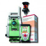
Leica Geosystems is pleased to announce the Leica Viva TS12 Performance Robotic Package. The cost-effective system provides everything needed for efficient daily surveying in one powerful package comprising the Leica Viva TS12 Total Station, the...
Wednesday, April 20th, 2011
Optical instruments from the Suzhou Company Limited, Shantou, Surveying Instrument Co., Ltd. sponsored the emerging "emerging in eastern Guangdong Province in 2011 new product launches" in at 14:00 on March 25 in Shantou Meritus Hotel. More than 100...
