Asian Surveying & Mapping
Breaking News
Intermap Announces $1 Million Program in Malaysia and Business Updates
DENVER – Intermap Technologies (TSX: IMP; OTCQB: ITMSF) (“Intermap” or...
From Kuala Lumpur To Singapore: Malaysia’s High-Speed Rail Resurgence Sparks China’s Pan-Asia Vision
The Malaysian government is once again working on building...
Japan’s Synspective successfully launches fourth SAR satellite
Synspective, the Japanese provider of Satellite/Synthetic Aperture Radar (SAR)...
South Korea’s Joowon Industrial Selects Aeva 4D LiDAR for Automated Power Line Inspection Program
MOUNTAIN VIEW, Calif. & SEONGNAM CITY, South Korea- Aeva®...
Synspective’s SAR Satellite, StriX-3, Successfully Reaches Its Target Orbit and Spreads Its Wings
TOKYO, 2024, March 13 – Synspective Inc., a SAR...
Indian Prime Minister Narendra Modi Commissions Genesys Digital Twin Map Stack in His Parliamentary Constituency
Mumbai: The Prime Minister of India, Mr. Narendra Modi, recently...
Geo Connect Asia 2024 to unveil geospatial’s transformative power
Geo Connect Asia (GCA) is set to return to...
Iran launches ‘domestically developed’ imaging satellite from Russia
The launch of Pars 1 is fourth this year,...
Astranis relocating hobbled debut satellite from Alaska to Asia
TAMPA, Fla. — Astranis is moving its debut satellite...
Asia space race heats up as China, Japan and India reach for the stars
After another year of US aeronautics company SpaceX dominating...

Ocean

Saturday, March 17th, 2012

New StructureScan HD Sonar Imaging System

Lowrance announced today the next-generation sonar imaging system, the LSS-2 StructureScan® HD. Raising the bar in fish- and structure-finding technology, the new system delivers more side-to-side coverage, as well as greater target and bottom definition allowing users...

Friday, February 24th, 2012

Mapping Australia’s Sea Floor

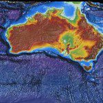
Covering nearly 71 per cent of the world and supporting nearly half of the world's species, the ocean is a mysterious and exciting world that's one of the remaining little-explored frontiers. Only a minute amount of the sea...

Monday, January 23rd, 2012

The BLUElink Project

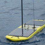
The Australian Government, through the Commonwealth Bureau of Meteorology, Royal Australian Navy and CSIRO has initiated BLUElink Ocean forecasting Australia, a $15m project to deliver ocean forecasts for the Australian region. Read More
Friday, December 9th, 2011

Interoperability and Data Exchange for the World’s Oceans

Interoperability and data format exchange capabilities are important to further the sharing of scientific results and improving collaboration about the world's oceans. The World Ocean Council has embarked on the challenge of bringing together the many diverse...

Saturday, November 19th, 2011

Scientists Meet in Oamaru to Discuss Results from Canterbury Ocean Drilling

About 40 scientists from nine countries are meeting in Oamaru this week to review results from a scientific ocean drilling expedition that took place off the coast of South Canterbury in early 2010. Using the seafloor drilling ship, JOIDES...
Thursday, July 14th, 2011

Ocean Exploration: Spatial Challenges in the Sea

China has increased it's pace to pursue ocean exploration, mapping and discovery of natural resources. A new submersible vessel named Jiaolong will explore the Pacific Ocean through a series of deep dives. Beginning at depths of 4,000 meters,...

Thursday, January 13th, 2011

Russia to Launch Ocean Satellite in March

Russia will launch an oceanography satellite in March to keep track of a vast amount of data that will help improve weather, climate and ocean forecasts, a Russian scientist said on Wednesday. "It will be a kind...

Wednesday, June 9th, 2010

Mapping the Pacific Ocean

The Pacific Ocean plays a dominate role to the many countries and people of Asia. This contribution can be measured in many ways, from food to resources, transport and weather moderation. But how much do we...