measurement
Thursday, June 9th, 2011
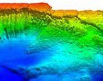
Airborne Lidar Bathymetry specialists, Fugro LADS Corporation, based in Adelaide, Australia have successfully completed acceptance trials of their new Fugro LADS Mk 3 Airborne Lidar Bathymetry (ALB) system and has been awarded a project by the New...

Thursday, June 9th, 2011
If you think location is important and everywhere, then think about measurement. It too is ubiquitous, everywhere and just as important. While satellites continuously circle the planet providing the latest details for highly accurate GNSS positioning, handheld...
Thursday, June 9th, 2011
Large room? No square corners? Slanted walls? Lots of detail? Difficult to reach? No need to worry: the rugged Leica 3D Disto measures it all. A combination of distance and angle measurements determines the precise position of...

Thursday, May 26th, 2011
Fully 70% of the world is covered by water. It has been said that we know more about the moon, than we do about the oceans. Recently Hawkes Ocean Technologies won recognition from CAD software company Autodesk for...
Tuesday, May 24th, 2011
Leica Geosystems is pleased to announce an additional software module of its successful Leica GeoMoS Monitoring Software. Leica GeoMoS HiSpeed is a professional software tool for sophisticated and reliable deformation analysis of high-frequency data. Together with a...
Thursday, May 19th, 2011
A system of vertical control is realised with the establishment of a levelling network whereby the height value of points may be defined. In early 1977, the Department of Survey and Mapping Malaysia (JUPEM) began to undertake...

Thursday, May 12th, 2011
During the past week Cambodia and the United Nations met together to discuss issues related to land degradation and desertification. Cambodia is a signatory to the United Nations Convention to combat Decertification (UNCCD) and the country currently 30 projects...
Wednesday, May 11th, 2011
SuperGeo Technologies announces the latest sales achievement in Australia, where Survey & Instrument Specialists selected SuperPad 3 through Cody Corporation. Cody Corporation, SuperGeo’s exclusive reseller in Australia and New Zealand, successfully promoted SuperPad 3 to Survey & Instrument...

Tuesday, May 3rd, 2011
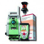
Leica Geosystems is pleased to announce the Leica Viva TS12 Performance Robotic Package. The cost-effective system provides everything needed for efficient daily surveying in one powerful package comprising the Leica Viva TS12 Total Station, the...
Monday, May 2nd, 2011
FARO Technologies, Inc. (NASDAQ: FARO), the world’s leading provider of portable measurement and imaging solutions, announces that it has enhanced its FARO Gage product line. These hardware and software improvements will simplify users’ measurement workflow and enhance...

