Asian Surveying & Mapping
Breaking News
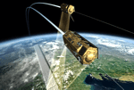
China Launches Earth Observation Satellite Gaofen-13 02 for Remote Sensing
China on Friday sent a new Earth observation satellite...
ISRO to conduct young scientist programme in Bengaluru
The Indian Space Research Organisation (ISRO) is organising a...
Egypt launches second remote-sensing satellite from China
The Egyptian Space Agency’s CEO, Sherif Sedky, announced the...
Israeli-developed DRONE DOME to secure Dubai from aerial attacks
Rafael Advanced Defense Systems Ltd. is supplying the system...
China launches 2nd Horus remote-sensing satellite for Egypt (video)
China has launched a second remote-sensing satellite for Egypt,...
China obstructs new subsea cable to Taiwan
Southeast Asia-Japan Cable 2 connecting Japan, Taiwan, Hong Kong,...
Scientific collaboration between China and US key to tackling climate change, experts say
Efforts to combat climate change bore the brunt of...
ISRO Receives India-US Jointly Built NISAR Earth Observation Satellite, Begins Preparations For Launch
US space agency NASA has handed over NISAR earth...
ISRO conducts parachute deployment tests on rail tracks for Gaganyaan Mission
Indian Space Research Organisation (ISRO) has conducted Rail Track...
OceanX helps Riyadh boost best up-and-comers in GEOINT
The Saudi Space Commission has given OceanX the difficult...

measurement

Thursday, January 26th, 2012

Johannes Riegl Jr. Appointed to Executive Management Group

In keeping pace with the success and growth of the corporation, RIEGL Laser Measurements Systems GmbH, Austria, announced today a new appointment to the executive management group. As of January 1st, 2012, Johannes Riegl Jr. was named the Chief...

Thursday, January 26th, 2012

Marine Ecosystems in the Mertz Glacier Region, Antarctica

In his account of the Australasian Antarctic Expedition of 1911–14, Sir Douglas Mawson (1915) described his encounter with large icebergs, resembling ice walls, during the voyage south to Adélie Land in January 1912: 'a south‒south‒east was blowing...

Monday, January 23rd, 2012

The BLUElink Project

The Australian Government, through the Commonwealth Bureau of Meteorology, Royal Australian Navy and CSIRO has initiated BLUElink Ocean forecasting Australia, a $15m project to deliver ocean forecasts for the Australian region. Read More

Monday, January 23rd, 2012

China’s Tree Monitoring Sensors Map Disease

The ARBOTOM determines tree defects in 3D including stem quality using acoustic sensors. Pulses are transmitted through trees and return signals that provide an indication of the disease levels. Read More

Monday, December 26th, 2011

Conference: Remote Sensing Data for Crop Rotation Mapping

The interdisciplinary research project CRC TR32: “Patterns in Soil-Vegetation-Atmosphere-Systems: Monitoring, Modelling and Data Assimilation” works on matter fluxes between soil, vegetation and atmosphere (SVA) on a regional scale. In this regard, high quality land use data is...

Tuesday, December 20th, 2011

Marine Ecosystems in the Mertz Glacier Region, Antarctica

In his account of the Australasian Antarctic Expedition of 1911–14, Sir Douglas Mawson (1915) described his encounter with large icebergs, resembling ice walls, during the voyage south to Adélie Land in January 1912: 'a south‒south‒east was blowing...

Wednesday, December 14th, 2011

Next Generation Focus3D Laser Scanner

FARO announces new state-of-the-art 3D Documentation technology. New Multi-Sensor hardware feature includes the Compass and Height Sensor which complement the existing Dual Axis Compensator for the FARO Focus3D. The two new sensors deliver the orientation and the...

Wednesday, December 7th, 2011

FARO Edge in PolyWorks V12

FARO announce the results of the integration tests of the FARO Edge measuring arm and the PolyWorks V12 software. On 30th September 2011, Duwe-3d AG made tests in their centre of excellence for 3D metrology in Lindau, extensively examining...

Thursday, November 24th, 2011

Wireless for Surveyor Solutions

Wireless technology has been innovating at a rapid rate and can now be found throughout the geomatics and geospatial sector. There are several advantages to using wireless, some more obvious than others. Because it does not involve...

Wednesday, November 23rd, 2011

FARO Laser Scanner Captures As-is Documentation for Wenchuan Earthquake Memorial

The Great Sichuan Earthquake took the globe by surprise when it happened in the early afternoon on May 12, 2008. Its sheer magnitude coupled with the density of the population made this one of...

Page 6 of 12 1 2 3 4 5 6 7 8 9 10 11 12