Asian Surveying & Mapping
Breaking News
Australia’s Gilmour Space Technologies ready to launch maiden Eris Test flight the nation’s first orbital launch in over 50 years
Gilmour Space Technologies is the leading launch services company...
Korea’s space agency seeks revision of plan to modify next-gen rockets into reusable system
South Korea's aerospace agency said on Thursday that it...
UAE Space Agency Signs Agreement With Technology Innovation Institute to Execute the Emirates Mission to the Asteroid Belt’s Lander Project
In the presence of His Highness Sheikh Hamdan bin...
Private Japanese lunar lander enters orbit around moon ahead of a June touchdown
A private lunar lander from Japan is now circling the moon, with...
Indian astronaut to travel soon to ISS as part of ISRO-NASA Mission
Prime Minister Narendra Modi said by 2040, an Indian’s...
China issues regulatory framework to support direct-to-device satellite services
HELSINKI — China has released comprehensive regulations for direct-to-device...
Astranis clinches $115 million Taiwan deal despite satellite setback
TAMPA, Fla. — Astranis has signed a $115 million...
UAE and Egypt Strengthen Space Collaboration with New MoU
In a milestone development for Arab space collaboration, the...
Seoul launches 4th spy satellite to boost North Korea surveillance
South Korea’s military now operates an increasingly integrated cluster...
Indonesia seeks space defense cooperation with Japan’s military
Jakarta (ANTARA) - The Ministry of Defense of Indonesia...

measurement

Saturday, March 17th, 2012

Russia Plans to Install GLONASS Ground Support Stations in 34 Countires

Russia plans to install ground support stations for its GLONASS global satellite positioning system in 34 countries across the globe, Russian Space Systems General Director and General Designer Yury Urlichich said. "We are considering 34 countries in which...

Saturday, March 17th, 2012

Sokkia Announces New Total Station Series for professionals – the FX

Sokkia announces a new reflectorless total station – the FX – that includes on-board MAGNET™ Field application software, a telematics-based communications module TSshield, and a long-range wireless...

Thursday, March 15th, 2012

Water at the Crossroads: Measure – Monitor – Map

Water is a valuable and important resource. Spatial data for water resources is captured through many kinds of map, imaging, surveying and other measurement tools. This data is used to monitor and understand these resources, and is...

Wednesday, March 14th, 2012

SOUTH Surveying – Winner of the Greatest Annual Prize of 2011 Was Announced

Geoteknik company has been awarded the "$1 Million Sales Award for 2011" early this month. They are receiving this award for their many contributions to the promotion and development of SOUTH brand GNSS products in Turkey market. In...

Tuesday, February 28th, 2012

Drone in Action for the Indonesian Rainforest

ETH-Zurich Assistant Professor Lian Pin Koh has built an autonomous drone that can be used for nature conservation purposes, such as surveying large mammals and monitoring the rainforest. He is excited about the initial results of the...

Friday, February 24th, 2012

How Cartographers Make Surveyors Look Good

Surveyors are experts at collecting spatial data with high accuracy and precision. But cartographers are masters when it comes to making maps and graphic products that represent surveying information. For users of cartographic products though, how the...

Wednesday, February 22nd, 2012

AEROmetrex Signs Distribution Agreement With Hawkeye UAV

Australian-owned AEROmetrex, leader in digital aerial data acquisition and processing, and New-Zealand company Hawkeye UAV, pioneer in commercial Uninhabited Aerial Vehicle (UAV) operations have signed a distributor agreement for AEROmetrex to market Hawkeye-UAV technology and imagery throughout...

Wednesday, February 15th, 2012

Marine Ecosystems in the Mertz Glacier Region, Antarctica

In his account of the Australasian Antarctic Expedition of 1911–14, Sir Douglas Mawson (1915) described his encounter with large icebergs, resembling ice walls, during the voyage south to Adélie Land in January 1912: 'a south‒south‒east was blowing...

Tuesday, February 14th, 2012

Vietnam – Water Quality Monitoring Systems Outdated

The water environment's observation system is too outdated to manage the large river systems and the rapid pace of development in the country.Viet Nam has a dense system of rivers and streams, which makes up 2 per...
Thursday, February 9th, 2012

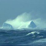
Ice Measurement Using Satellite Images

Sea ice is an important contributor to global climate changes. Specifically, sea ice thickness helps to understand ocean circulation and heat transfer.  The ability to capture more information about global sea ice thickness has advanced considerably and...

Page 1 of 7 1 2 3 4 5 6 7