Asian Surveying & Mapping
Breaking News
South Korea partially suspends inter-Korean agreement over North’s spy satellite
SEOUL, South Korea -- South Korea said North Korea fired...
Chinese software firm inks deal with Kenya to boost geospatial technology cooperation
Chinese technology firm, Supermap International, signed an agreement with...
Survey of India, Genesys International Sign MoU to Develop ‘Digital Twins’ Of Indian Cities
Genesys International, India’s home-grown geospatial mapping company and Survey...
UAE Space Agency leads first Space Pavilion participation at COP28
DUBAI - The UAE Space Agency is leading the...
ISRO, NASA likely to launch remote sensing satellite in 1st half of ’24
NEW DELHI: If everything goes as per plan, India...
IBM Advances Geospatial AI to Address Climate Challenges
YORKTOWN HEIGHTS, N.Y.- IBM (NYSE: IBM) today announced new...
Australia Greenlights Game-Changing Era: Commercial Drones with ParaZero Safety Systems to Fly
ParaZero is thrilled to be at the forefront of...
Asia’s top satellite operator aims to launch solar energy forecast system in Europe
Japan’s satellite titan SKY Perfect JSAT aims to expand...
Japan to set up $6.7bn JAXA fund to develop space industry
TOKYO -- Japan's cabinet on Monday approved a bill...
China launches a satellite to compete with Elon Musk’s Starlink
This was stated by Business Insider, citing a report...

measurement

Saturday, March 17th, 2012

Russia Plans to Install GLONASS Ground Support Stations in 34 Countires

Russia plans to install ground support stations for its GLONASS global satellite positioning system in 34 countries across the globe, Russian Space Systems General Director and General Designer Yury Urlichich said. "We are considering 34 countries in which...

Saturday, March 17th, 2012

Sokkia Announces New Total Station Series for professionals – the FX

Sokkia announces a new reflectorless total station – the FX – that includes on-board MAGNET™ Field application software, a telematics-based communications module TSshield, and a long-range wireless...

Thursday, March 15th, 2012

Water at the Crossroads: Measure – Monitor – Map

Water is a valuable and important resource. Spatial data for water resources is captured through many kinds of map, imaging, surveying and other measurement tools. This data is used to monitor and understand these resources, and is...

Wednesday, March 14th, 2012

SOUTH Surveying – Winner of the Greatest Annual Prize of 2011 Was Announced

Geoteknik company has been awarded the "$1 Million Sales Award for 2011" early this month. They are receiving this award for their many contributions to the promotion and development of SOUTH brand GNSS products in Turkey market. In...

Tuesday, February 28th, 2012

Drone in Action for the Indonesian Rainforest

ETH-Zurich Assistant Professor Lian Pin Koh has built an autonomous drone that can be used for nature conservation purposes, such as surveying large mammals and monitoring the rainforest. He is excited about the initial results of the...

Friday, February 24th, 2012

How Cartographers Make Surveyors Look Good

Surveyors are experts at collecting spatial data with high accuracy and precision. But cartographers are masters when it comes to making maps and graphic products that represent surveying information. For users of cartographic products though, how the...

Wednesday, February 22nd, 2012

AEROmetrex Signs Distribution Agreement With Hawkeye UAV

Australian-owned AEROmetrex, leader in digital aerial data acquisition and processing, and New-Zealand company Hawkeye UAV, pioneer in commercial Uninhabited Aerial Vehicle (UAV) operations have signed a distributor agreement for AEROmetrex to market Hawkeye-UAV technology and imagery throughout...

Wednesday, February 15th, 2012

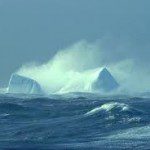
Marine Ecosystems in the Mertz Glacier Region, Antarctica

In his account of the Australasian Antarctic Expedition of 1911–14, Sir Douglas Mawson (1915) described his encounter with large icebergs, resembling ice walls, during the voyage south to Adélie Land in January 1912: 'a south‒south‒east was blowing...

Tuesday, February 14th, 2012

Vietnam – Water Quality Monitoring Systems Outdated

The water environment's observation system is too outdated to manage the large river systems and the rapid pace of development in the country.Viet Nam has a dense system of rivers and streams, which makes up 2 per...
Thursday, February 9th, 2012

Ice Measurement Using Satellite Images

Sea ice is an important contributor to global climate changes. Specifically, sea ice thickness helps to understand ocean circulation and heat transfer.  The ability to capture more information about global sea ice thickness has advanced considerably and...

Page 1 of 7 1 2 3 4 5 6 7