Monday, March 28th, 2011
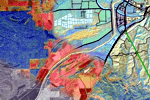
CartoVista 3 has been entirely re-architected and optimized for a faster display and provides more control over the map thematic analyses. The solution now supports unlimited thematic analyses from different interactive vector layers all at...

Thursday, March 24th, 2011
The occurrence of radiation within the Japanese food supply is raising concern for both local and international consumers of food products from impacted areas - and even those areas that are completely safe. Accurate information about the...

Thursday, March 24th, 2011
Geophysical activity around the globe results in a need to monitor the earth's physical activity closely. Earthquakes, volcanoes and geological investigations are all monitored so internal and surface activities can be studied, understood and even modeled. Recent...

Thursday, March 24th, 2011
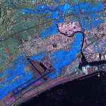
The German Remote Sensing Data Center (Deutsches Fernerkundungsdatenzentrum; DFD) and the German Space Operations Center (GSOC), both of which are part of the German Aerospace Center (Deutsches Zentrum für Luft- und Raumfahrt; DLR), are continuing to provide...
Monday, March 21st, 2011
National Economic and Development Authority (NEDA) Caraga will launch its Regional Geographic Information System Center (RGISC) on March 22. The RGISC promotes Geographic Information System (GIS) as a tool for effective planning, decision-making, policy formulation, investment programming and...
Sunday, March 20th, 2011
Stakeholders and landowners present at the launch of the Fiji National REDD-plus policy were in a collective agreement that significant progress had been made towards the establishment of a national MRV (measuring, reporting, and verification) system. The two...

Saturday, March 19th, 2011
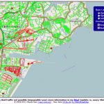
A dynamic map overlay showing the Road Status after the Earthquake in Sendai, Japan, based on the user generated maps from OpenStreetMap has been generated by Pascal Neis, member of the GIScience Research Group of the University...
Wednesday, March 16th, 2011
Sahana is a Free and Open Source Disaster Management system. It is a web based collaboration tool that addresses the common coordination problems during a disaster from finding missing people, managing aid, managing volunteers, tracking camps effectively...
Wednesday, March 16th, 2011
The objectives of the consultancy are in general to provide appropriate training, technical and project management support. The actual production work has to be done by NBS. The main goal is the empowerment...

Wednesday, March 16th, 2011
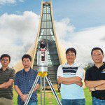
Linkfast Technology Co., Ltd., a Taiwan-based survey solutions provider of Geographical Information Systems (GIS) data, and a reseller of 3D laser scanning technology, has joined the Pointools Partner Program in Asia. Pointools software is used by project...