Tuesday, December 6th, 2011
The New Zealand Geospatial Strategy, published in January 2007, aims to better coordinate and manage the use of New Zealand's geospatial resources across all tiers of society. It addresses the increasing reliance on geospatial information in New...
Tuesday, December 6th, 2011
SuperGIS Server, developed by SuperGeo, has been successfully applied to “Yilan Pollution Control GIS.” To effectively manage and control the pollution data and distribution in Yilan, Department of Environmental Protection Yilan adopts SuperGIS Server to build “Yilan Pollution...

Friday, December 2nd, 2011
Agricultural food production is linked closely to geospatial technologies. From an agronomic perspective, variable rate (VR) approaches are about much more than nitrogen fertilizer applications alone. Plants depend upon several macro-nutrients and micro-nutrients as well as other...
Saturday, November 26th, 2011
The State Committee for Property Affairs of Azerbaijan is satisfied with GFA/GCI consortium’s work fulfilled by Germany’s KfW order within the concept phase of Real Estate Registration & Cadastre Project in Azerbaijan. In particular, it helped clarify...
Monday, November 21st, 2011
“AECOM is excited to continue our successful relationship with AeroMetric on these A-GIS/eALP projects. Our collective experience on similar projects throughout the U.S. will enable us to coordinate efficiently as we focus on creatively solving problems stemming...
Friday, November 18th, 2011
For the first time ever, the International GIS Day is set to be celebrated in Southern Leyte on November 17, 2011 spearheaded by the Deutsche Gesellschaft für Internationale Zusammenarbeit (GIZ) GmbH – Environment and Rural Development (EnRD)...
Friday, November 18th, 2011
In its efforts to promoting awareness on the use of Geographic Information System (GIS), this city’s local government together with the University of the Philippines Visayas Tacloban College-Regional Environmental Information System (UPVTC-REIS) last November 17 celebrated the...

Wednesday, November 16th, 2011
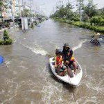
The number and severity of flood events throughout Asia has increased in recent times. Cambodia, Laos, Thailand, Burma and Vietnam have all experienced major flood disasters recently. Integrated flood management is emerging as a comprehensive approach for...
Friday, October 28th, 2011
The Geospatial Information Authority of Japan (GSI) has been targeted in a cyber attack, Minister of Land, Infrastructure, Transport and Tourism Takeshi Maeda told a news conference on Oct. 28 -- the latest in a series of...
Thursday, October 20th, 2011
Pradeep Nair, director (software group), IBM India & South Asia said the company was talking to a couple of non-metro municipal and state governments to connect a city’s water management data, traffic on roads via GPS tracking,...