Asian Surveying & Mapping
Breaking News
HAL to build, market Isro’s SSLV in landmark deal
New Delhi, Jun 20: In a historic move for...
Taiwan developing space capabilities for all-weather imaging
TAIPEI (TVBS News) — Taiwan is advancing its space...
Honda hails successful test of reusable rocket as it looks to get into the space business
Tokyo — Japan's second-biggest carmaker, Honda, has successfully tested...
China’s space program provides larger platform for broader international cooperation
BEIJING -- Experts from China's manned space program said...
India To Launch $1.5 Billion Joint Earth Mission With NASA In July
National Aeronautics and Space Administration (NASA) and the Indian...
Axiom-4 mission delayed again: ISRO confirms Subhanshu Shukla’s ISS spaceflight won’t launch before 22 June 2025
The Axiom-4 mission to the International Space Station has...
Mengzhou spacecraft for China’s moon-landing mission passes landmark test flight
China has completed the inaugural test flight of its...
Space application for ITMA Asia + CITME 2026 opens
Shanghai – Space application for the 2026 edition of...
Yanmar, Chia Tai and XAG Empower Thai Agriculture through Innovation
Bang Nam Priao District, Chachoengsao Province, Thailand – On...
bitsensing Signs MOU with IKIO Technologies to Advance AI-Based Traffic Monitoring on India’s Expressways, Highways and Municipal Areas
Backed by proven success in South Korea and Europe,...

Geospatial

image

Friday, September 10th, 2010

The Move Toward Intelligent Infrastructure Promises Geospatial Advancements

The concept of intelligent infrastructure involves the combination of sensors, network connectivity and software to monitor and analyze the inputs for more efficient operations. This concept meshes nicely with advancements in...
Friday, June 25th, 2010

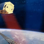
TanDEM-X Adds More Elevation Data

The TanDEM-X satellite was successfully launched recently. It is expected to provide a 12 m resolution digital elevation dataset for use around the globe. It marks yet another step in the...

Tuesday, December 8th, 2009

Malaysia Will Task TerraSAR-X Satellite Directly

Infoterra and its Malaysian partner IMS have now installed a TerraSAR-X Virtual Ground Station at the Malaysian Remote Sensing Agency (MRSA) in Kuala Lumpur: Following the delivery and installation of all necessary technical equipment as well as...

Monday, July 16th, 2007

Interview with BVR Mohan Reddy, the Chair of Infotech

BVR Mohan Reddy is the chairman and managing director of Infotech Enterprises Limited, based in Hyderabad, India. He founded Infotech in 1991, as a technology services and solutions company. Along with its engineering and IT services, Infotech...

Friday, February 16th, 2007

Indian Arrangements to Change says Kapil Singh

In a keynote presentation to the Map World Forum in Hyderabad last month, India's minister of science, Kapil Sibal, outlined the importance for the industry of new government initiatives. They are likely to have ramifications...

Page 23 of 23 1 18 19 20 21 22 23