Asian Surveying & Mapping
Breaking News
HAL to build, market Isro’s SSLV in landmark deal
New Delhi, Jun 20: In a historic move for...
Taiwan developing space capabilities for all-weather imaging
TAIPEI (TVBS News) — Taiwan is advancing its space...
Honda hails successful test of reusable rocket as it looks to get into the space business
Tokyo — Japan's second-biggest carmaker, Honda, has successfully tested...
China’s space program provides larger platform for broader international cooperation
BEIJING -- Experts from China's manned space program said...
India To Launch $1.5 Billion Joint Earth Mission With NASA In July
National Aeronautics and Space Administration (NASA) and the Indian...
Axiom-4 mission delayed again: ISRO confirms Subhanshu Shukla’s ISS spaceflight won’t launch before 22 June 2025
The Axiom-4 mission to the International Space Station has...
Mengzhou spacecraft for China’s moon-landing mission passes landmark test flight
China has completed the inaugural test flight of its...
Space application for ITMA Asia + CITME 2026 opens
Shanghai – Space application for the 2026 edition of...
Yanmar, Chia Tai and XAG Empower Thai Agriculture through Innovation
Bang Nam Priao District, Chachoengsao Province, Thailand – On...
bitsensing Signs MOU with IKIO Technologies to Advance AI-Based Traffic Monitoring on India’s Expressways, Highways and Municipal Areas
Backed by proven success in South Korea and Europe,...
vr farming

Some agriculturalists suggest that many crops today are not reaching their genetic potentials. They suggest that genetic breeding is designed to yield as much as 60% more food, but instead, crop management strategies are not living up to the promise – sometimes macro-micro or other variables are not properly managed. 

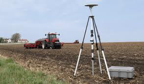
Geospatial technologies can be used for developing landscape topography, the creation of maps that identify and include nutrient levels etc. All too often VR is taken to mean nitrogen management alone for many locations, when considers involving boron, magnesium, sulphur and other factors needs equal consideration. 

Geospatial tools have the potential to rapidly increase the level of food production through better understanding of the broad management of agronomic principals.

The baselining of operations is a sound beginning point, and maps and digital records that provide improved documentation can help. The objective of digital record-keeping is to improve the decision-making capability of the operation while decreasing the level of risk.

As farmers work with VR technologies they can expect ttheir knowledge to increase, and the development of management strategies to become less time demanding. Ultimately, improved record management will lead to increasing the value of the operation – and for all producers, that is the challenge.