Asian Surveying & Mapping
Breaking News
Australia’s Gilmour Space Technologies ready to launch maiden Eris Test flight the nation’s first orbital launch in over 50 years
Gilmour Space Technologies is the leading launch services company...
Korea’s space agency seeks revision of plan to modify next-gen rockets into reusable system
South Korea's aerospace agency said on Thursday that it...
UAE Space Agency Signs Agreement With Technology Innovation Institute to Execute the Emirates Mission to the Asteroid Belt’s Lander Project
In the presence of His Highness Sheikh Hamdan bin...
Private Japanese lunar lander enters orbit around moon ahead of a June touchdown
A private lunar lander from Japan is now circling the moon, with...
Indian astronaut to travel soon to ISS as part of ISRO-NASA Mission
Prime Minister Narendra Modi said by 2040, an Indian’s...
China issues regulatory framework to support direct-to-device satellite services
HELSINKI — China has released comprehensive regulations for direct-to-device...
Astranis clinches $115 million Taiwan deal despite satellite setback
TAMPA, Fla. — Astranis has signed a $115 million...
UAE and Egypt Strengthen Space Collaboration with New MoU
In a milestone development for Arab space collaboration, the...
Seoul launches 4th spy satellite to boost North Korea surveillance
South Korea’s military now operates an increasingly integrated cluster...
Indonesia seeks space defense cooperation with Japan’s military
Jakarta (ANTARA) - The Ministry of Defense of Indonesia...

floods

Thursday, January 19th, 2012

Global Map of Northern Mindanao, the Philippines

Torrential rain by Typhoon 21 which landed Mindanao on December 16th caused extensive damage of flood, land slide, etc. to Cagayan de Oro, Iligan and their vicinities of northern Mindanao of southern Philippines. Global Map of Northern...
Thursday, December 22nd, 2011

Data Intelligence: The Australian Flood Prevention Wall

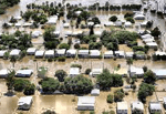
Last year saw extensive flood damage throughout the Brisbane, Australia area. Damage estimates were in the billions of dollars. Infrastructure was destroyed, crops were submerged and the energy industry was impacted significantly. The toll on human life...

Wednesday, December 21st, 2011

Pitney Bowes Business Insight Understands The Cost of Floods to Communities

Floods happen, it is a way of Australian life. What we do to reduce the impact on our communities is what matters. Pitney Bowes Business Insight understands the cost and complexity many local authorities face as they...

Monday, June 6th, 2011

GIS Proves Key to Flood and Fire Management

Geographic Information System (GIS) technology is the key to reducing the social and economic tolls of flood, fire and extreme weather events, according to Gary Johnson, Esri Australia Principal Consultant for Financial Services, speaking at the Australian...

Thursday, January 13th, 2011

Flood Inundation Mapping- An Application of Remote Sensing Techniques

This paper describes two applications of remote sensing on a near-real time mapping of flood inundation and crop health in the light of natural disaster and crop monitoring. The mapping of flood inundation was carried out over...

Thursday, December 30th, 2010

Queensland State Disaster Management Group

Whilst many parts of Queensland have commenced recovery efforts, other areas are bracing for more flooding. Queensland Police Service Assistant Commissioner Brett Pointing said that additional police have been sent to many areas affected by floods including Emerald,...