Wednesday, August 10th, 2011
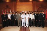
SuperGeo Technologies, the leading global provider of complete GIS software and solutions, announced that the Ministry of Lands and Mineral Resources, Fiji, selected GPS Learning CD for the staff to learn comprehensive GPS knowledge about the operating...
Monday, August 8th, 2011
Land Information New Zealand (LINZ) today announced its sponsorship of the Support for Canterbury Earthquake Recovery Data Mashup category in The Great New Zealand Remix and Mashup Competition launched in Auckland this week. The LINZ sponsored category calls for the...
Monday, August 1st, 2011
For the first time in India, Manipur has introduced Geographic Information System (GIS) for mapping schools located in remote areas of the State. With the introduction of GIS, effective monitoring can now be done whether or not funds...
Monday, July 25th, 2011
The Academic Staff College of Gauhati University will coordinate a satellite-based training programme on basics of remote sensing, geographic information system and geographic positioning system from August 1 this year. "The experts from the Indian Institute of...
Tuesday, July 19th, 2011
Designed for a college curriculum, Making Spatial Decisions Using GIS: A Workbook helps students use organized workflows, spatial analysis, and visualization to make decisions about real-world issues including crime, hazards, hurricanes, demographics, and urban planning....

Thursday, July 14th, 2011
The first in a series of courses on the theoretical and practical aspects of hydrographic database design and management to support the development of marine, national and regional spatial data infrastructures (SDI) was delivered successfully from 20...
Thursday, June 30th, 2011
Surrounding the construction of distance education networks for rural party cadres, Wenshang has earmarked special funds from county and township finance to build terminal receiving stations in rural areas, which include 14 town-level stations, 1 education base...
Wednesday, May 11th, 2011
To register for the upcoming programs, kindly complete the Training Registration Form and email to [email protected] A confirmation email will be sent thereafter if the class is to commence.
Wednesday, May 11th, 2011
The UAE's space research and applications sector is currently the most advanced in the Middle East. Satellite-based land imaging and related services for the region alone are expected to become a $5.2bn business by 2013. The country recently...

Thursday, May 5th, 2011
Around the globe today we can find many geospatial resources connected to geographic information systems (GIS) and general map making-cartography provided to junior grade education classes. But that is not the case for surveying, GNSS and other...