Asian Surveying & Mapping
Breaking News
China launches new set of classified Yaogan-43 satellites
HELSINKI — China launched a second group of classified...
China-Africa space cooperation benefits people across continent
The Egyptian satellite MISRSAT-2, a high-resolution optical remote-sensing satellite,...
Abu Dhabi astronomers discover new asteroid
ABU DHABI: The International Astronomical Centre in Abu Dhabi...
UAE’s First Private Space Infrastructure Company Launched by Marlan Space and Loft Orbital
Abu Dhabi-based Marlan Space, a new space company affiliated...
Japan’s space agency ends Moon probe operation
Japan's space agency said on Monday it had ended...
Chinese researchers assess U.S. space situational awareness, call for boost in China’s capabilities
HELSINKI — Chinese researchers are calling for improved space...
Japan’s Astroscale wins contract for space junk harvesting robotic arm
Japanese space debris cleaning outfit Astroscale revealed on Monday...
SpaceX rocket carries 2 Taiwan-developed satellites into space
Taipei, Aug. 17 (CNA) A Falcon 9 rocket launched...
Bayanat, Yahsat launch UAE’s first SAR satellite
California , August 17 (ANI/WAM): Bayanat AI PLC (ADX:...
Long March 4B launches experimental Yaogan-43 satellite group
HELSINKI — China successfully launched the first of a...

agriculture

Wednesday, August 24th, 2011

Trimble Expands Harvest Solution to Include Yield Monitoring and Row Guidance

Trimble introduced today yield monitoring and row guidance capabilities providing farmers with an integrated solution to meet their harvesting needs. Expanding on Trimble's Connected Farm™ solutions, which wirelessly sync precision farming data, these...

Sunday, August 21st, 2011

Juniper Systems Announces IntuiTrace Irrigation Mapping Software

Juniper Systems announces the shipment of IntuiTrace Irrigation Mapping Software. After successful development and extensive testing, IntuiTrace is officially released and available for order. IntuiTrace is a state of the art mobile irrigation mapping tool designed to...

Friday, August 12th, 2011

Agrisoft and OpenGeo Partner to Support Indonesian Geospatial Software Users

Agrisoft Citra Buana, PT and OpenGeo producer of the OpenGeo Suite, announced a new collaboration to establish an official OpenGeo Suite reseller in Indonesia. Agrisoft is the latest company to join the rapidly growing OpenGeo global partner...
Thursday, August 11th, 2011

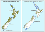
New Zealand Embarks on Four-Year, $4 Million Mapping Programme

The government of New Zealand has announced a research programme today to use satellite imagery and geospatial mapping to map forests, pastures, rivers and cities across the country. The four-year Land Cover Research Programme was launched with...

Wednesday, August 10th, 2011

Hemisphere GPS Reports 29% Growth for Second Quarter

For the second quarter ended June 30, 2011, Hemisphere GPS achieved revenue growth of 29%, reporting $20.1 million in revenues, compared to$15.6 million in the second quarter of 2010 with strong growth in each of the Company's segments and general economic...

Wednesday, July 27th, 2011

Australia’s Biggest Agricultural Industry Field Day Event

The giant field days are staged over three days in August in Gunnedah, New South Wales, Australia. It attracts over 100,000 visitors, the largest visitation of any rural field day in the country. Since it started in 1973,...

Wednesday, June 15th, 2011

Hemisphere GPS – New Outback Guidance Long Range RTK Solution

From the Western Canada Farm Progress Show in Regina, Saskatchewan, Hemisphere GPS announced the availability of long range RTK for Outback Guidance systems featuring Hemisphere GPS' Eclipse™ GNSS receivers. Available in the new Outback A220™ series receivers as well...

Thursday, June 9th, 2011

Viet Nam – To Boost Rural Areas, says PM

Building a new rural model is an urgent mission and a strategic policy for the sustainable development of Viet Nam, said Prime Minister Nguyen Tan Dung at the launching ceremony for the Central Council for Emulation and...
Tuesday, May 31st, 2011

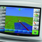
Leica Geosystems Updates Ag Guidance Solutions

Leica Geosystems today announces several updates for a range of Ag guidance products. Compatibility with the SteerDirect hydraulic kit solution continues to grow with another four series of tractors added. Autospray with Direct Section Control for Amazone...

Friday, May 20th, 2011

Hemisphere GPS Reports 2011 First Quarter Results

For the first quarter ended March 31, 2011, Hemisphere GPS achieved revenue growth of 41%, reporting $21.2 million in revenues, compared to $15.1 million in the first quarter of 2010. Revenues from all market segments increased in the first quarter. "The...

Page 4 of 6 1 2 3 4 5 6