Wednesday, February 15th, 2012
Thanks to the Aibot X6 agricultural experts can increase their crop yield, reduce their costs and protect the environment. Agriculturalists have to know which parts of their farmland need what kind of fertilization. UAV drones such as...
Friday, January 20th, 2012
The Food and Agriculture Organisation (FAO) and the European Commission Monday announced a new 5.3 million-euro (US$7.95 million) project that helps promote climate-smart farming in Viet Nam, Malawi and Zambia. Read More
Saturday, January 7th, 2012
Strategic cropping land is an important, finite resource that is subject to competing land uses from the agriculture, mining and urban development sectors. The government aims to strike a balance between these sectors to help maintain the...

Wednesday, January 4th, 2012
Higher commodity prices are resulting in higher bottom lines for many agricultural producers today. Productive agricultural land is no longer readily available, and a growing global population increasingly depends upon technological innovation to meet consumer needs. As...
Monday, January 2nd, 2012
Until not too long ago, Government of India and the sugar industry manually estimated the area under sugarcane cultivation. This system involved the collection of estimates from the field and the compilation of data. That system had...
Sunday, December 18th, 2011
Cutting-edge technology is enhancing the surveillance capabilities of biosecurity officers from the Department of Agriculture, Fisheries and Forestry (DAFF) and Indigenous ranger groups in Australia’s remote northern region. Community Liaison Officers with the DAFF Northern Australia Quarantine Strategy...
Monday, December 12th, 2011
Headwall Photonics has announced that its Micro-Hyperspec imaging sensor is being successfully deployed aboard very small commercial UAVs to help agriculturalists and researchers monitor vegetation over wide areas. Accurate spectral scenes of farmlands and crop fields can now...
Wednesday, December 7th, 2011
The State of Land and Water Resources (SOLAW) is FAO's first flagship publication on the global status of land and water resources. It is an 'advocacy' report, to be published every three to five years, and targeted...
Friday, November 18th, 2011
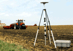
Students will gain knowledge and hands-on experience with current and emerging PA technologies such as EM38 soil sensors, GNSS survey equipment, ground-based optical plant canopy sensors, airborne optical sensors, spatial livestock tracking technologies, the 'Pastures from Space'...