Asian Surveying & Mapping
Breaking News
South Korea is converting an abandoned coal mine into a moon exploration testing ground
South Korea is transforming abandoned coal mines into testing...
ISRO to Launch Chandrayaan-5 With Japan, Plans Space Station
Dr. V. Narayanan, Chairman of the Indian Space Research...
Russia and China are threatening SpaceX’s Starlink satellite constellation, new report finds
SpaceX's Starlink satellite constellation is facing threats from Russia...
China and Pakistan agree to fly 1st foreign astronaut to Chinese space station
For the first time, the Chinese space program will train...
ISRO’s “Space on Wheels” offers a peek into Indian Space Programme to students in Karimnagar
The Indian Space Research Organisation (ISRO)’s “Space on Wheels”...
Geospatial led solutions build the foundations for better decision-making
Geo Connect Asia 2025 paves the way for turning...
GEOSA, Singapore Land Authority Launch Achievements of Joint Geospatial System Project
Riyadh, SPA -- The General Authority for Survey and...
Building in Bangkok collapses as powerful earthquake hits southeast Asia
One person has died and 50 were injured in...
Bellatrix Aerospace Partners with Astroscale Japan for Space Debris Removal
Bellatrix Aerospace, a Bengaluru-based space mobility company, has joined...
NSTC announces Pingtung site as Taiwan’s space mission launch center
Taipei, March 26 (CNA) Taiwan's National Science and Technology...

3d data

Monday, February 7th, 2011

Next-generation 3D Accelerates Geographic IT App Market

Agency9 provides leading web based 3D visualisation solutions for Geographic IT and on-line visualisation. The company aims at an aggressive acceleration of the market for 3D geographic information. Agency9 today announced the release of their platform, 3DMaps...
Tuesday, January 18th, 2011

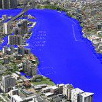
AAM Modeling Aids Australia Flood Crisis

AAM’s 3D Flood Simulation of Brisbane was used extensively by Australian and Global media during the recent flood crisis in Brisbane. The flood level simulations were produced interactively in 3D. This was a very effective way of communicating...

Wednesday, December 15th, 2010

FARO and Gexcel Announce the Release of JRC 3D Reconstructor

FARO and Gexcel, software and solutions provider in the Geomatics sector, announce the release of the new JRC 3D Reconstructor / FaroArm, a Gexcel software solution fully optimized for the FARO Laser ScanArm that enables to overlay...

Friday, October 15th, 2010

Extending Spatial Software to Decision Making

Traditionally the spatial information sector has been very good at collecting geodata and processing it. The number and types of different sensors has grown from digitization to aerial imagery and now includes integrated sensors that are able...

Wednesday, May 16th, 2007

Virtually Offshore

Petrochemical facilities that were built in an era before Computer Aided Design often have little or no documentation about the way things were originally constructed. That makes it difficult to design a refit. But lasers...

Page 5 of 5 1 2 3 4 5