
Thursday, August 25th, 2011
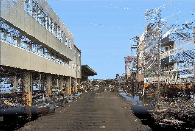
StreetMapper, the vehicle-based laser mapping system, is being used to assess the damage caused by the Japanese earthquake of the 11th March 2011. The mobile mapping system, purchased from Mirukuru and operated by Asia Air Survey, has...

Thursday, August 11th, 2011
Building Information Modeling (BIM) provides many benefits. An increasing number of projects are now demanding BIM inclusion as the advent of new modeling and design technologies are coupling survey quality data into them, often providing 3D capabilities....
Wednesday, August 10th, 2011
Intergraph has released the newest version of Standard Database for SmartPlant Reference Data, a pre-configured, best-practice solution to enable rapid implementation of SmartPlant 3D and SmartMarine 3D (collectively known as Smart 3D), and materials management. The Standard...
Wednesday, August 10th, 2011
Velodyne Lidar, Inc., announced that it has signed an agreement with Argo Corporation to serve as Velodyne’s exclusive reseller of HDL-64E and HDL-32E high definition 3-D LiDAR sensors in Japan. Velodyne’s LiDAR sensors are primarily designed for...
Wednesday, July 6th, 2011
Optech Incorporated is pleased to announce the Real-Time Point Cloud (RTPC) interface, a new feature delivered with the Lynx Mobile Mapper M1. During data collection, RTPC displays real-time 3D point cloud XYZi data. The point cloud display...
Tuesday, June 28th, 2011
iiView is primarily a Flash based Web Viewer for visualization of 3D Geo spatial Video link with Super Wide Angle Image. By adopting Adobe Flash , our 3D Viewer can be widely used and the application becomes more...
Sunday, June 19th, 2011
We are now offering a great Trade-In for your older 3D machine control systems! For a limited time, Topcon is offering a huge Trade-In for any 3D Motorgrader, Dozer or Excavator system from any manufacturer.
Thursday, June 9th, 2011
Trimble introduced today Trimble RealWorks version 7.0, the first commercially available software suite that incorporates the newly approved ASTM International E57 E2807 data exchange standard for 3D imaging systems. Trimble RealWorks version 7.0 allows 3D laser scanning professionals...
Thursday, May 12th, 2011
The 3D Web Client "XNavigator" is a virtual globe application that acts as client to a "Web 3D Service (W3DS)". W3DS is a draft specification by the OpenGeospatial Consortium (OGC), that has been extended by Arne Schilling...