It has enormous power to convert data into information as per will of the user/s by clicking few mouse buttons in the computer. It provides a unique opportunity for integration of data and information on natural and human resources, and environment which in turn helps developing decision support system for planners, administrators, decision makers and researchers of physical, biological, chemical and social sciences. A thorough understanding of GI Science is, therefore, necessary for effective utilization of natural resources and in efficient administration, planning, monitoring and decision making.
The Inaugural Event
To decissiminate the technologies of this (GI Science) newly emerging discipline of applied sciences, the Centre of Excellence for Natural Resources Data Management System (NRDMS- established under the DST Government of India research projects) of the Kumaun University, organized a Seven Day Training Workshop on GI Science and Technology for University and College teachers under the sponsorship of Uttarakhand Space Application Centre (USAC), Government of Uttarakhand.
Twenty Associate and Assistant Professors of 13 different disciplines (i.e, Geography, Botany, Geology, Physics, Zoology, Forestry, Environmental Science, Chemistry, Rural Technology, Biotechnology, Sociology, Economics and History) of three different Universities (i.e., Kumaun University, Garhwal University and SHIAT Deemed University Allahabad) participated in the training workshop.
In the opening ceremony of the training workshop on 3rd January 2011, Prof. J.S. Rawat, the Coordinator of the training workshop and Director, Centre of Excellence for NRDMS in Uttarakhand, Department of Geography, Kumaun University, SSJ Campus Almora, briefed about the objectives of the training programme on GI Science and Technology. Prof. Rawat said that the fundamental objective of this training programme is to disseminate the technologies of GI Science among University/College teachers by which they could make use of these technologies to update their subject.
In his inaugural address Prof. V.P.S. Arora, Vice Chancellor, Kumaun University Nainital said that GI Science has enormous power to generate and access information quickly with maps. Today, entire the world is using this science in research, development planning, management, administration and decision making, Prof.Arora added. For benefit of the society, today not only the teachers but administrators, planners, managers, decision makers everybody has to update themselves with this science, Prof. Arora suggested.
Dr.M.M.Kimoti, Director, USAC, Dehradun informed that using remote sensing data as input, their Centre has developed Geographic Information System of different sectors of resources of the Uttarakhand State but due to the lack of educated/trained human resource in GI Science technologies in different government departments, application of these useful information is not being done properly. Dr. Kimoti said that organizing training workshop on GI Science like this shall help in disseminating these technologies among the teachers by which they may be able to update their subject. The Kumaun University should conduct such training programmes twice a year including officers of different government departments, Dr. Kimoti suggested.
Highlighting the significance of GI Science in police administratin, Mr. P.S.Rawat, Superintendent of Police, District Almora, Uttarakhand, did appreciate the efforts of the Centre of Excellence for NRDMS of Kumaun University for inducting GI Science in higher education and for disseminating technologies of this newly emerging science through organizing training workshop.
He said that with the technical help of this Centre we are using GIS in our day to day works of policing. We are planning to organize a workshop jointly with the NRDMS Centre in the month of February 2011 on application of GI Science in Disaster Management and Crime Control, Mr. Rawat informed.
In the second half of the first day, Prof.J.S.Rawat gave an overview of G I Science to the participants and said that it has two powerful input technologies, i.e., RS (Remote Sensing) and GPS (Global Positioning System) by which data from the real world are captured and then stored in the computer under the format of Geographic Information System (GIS) which helps to convert data into information within few seconds as per will of the user/s. Mrs. Sarala, Scientist, USAC, Dehradun taught about the basics of remote sensing which include fundamental concepts of remote sensing, principles of electromagnetic energy, sensors and resolutions used in remote sensing technology.
On the second day, Dr. P.S.Kushwaha, Head, Forestry Division, Indian Institute of Remote Sensing Dehradun gave detailed presentation on applications of remote sensing in forestry. Dr. Kushwaha diagrammatically illustrated identification of deforestated, afforested, forest fire areas and of different tree species including fruit trees.
Dr. D.N.Pant (Retd.Professor) Indian Institute of Remote Sensing, Dehradun illustrated applications of remote sensing technology in watershed management, land evaluation, landuse planning and in change detection. Dr. Pant suggested that GI Science is very useful for planners, administrators, teachers, researchers and decision makers, therefore, there is a need to give training on applications of GI Science to all of these.
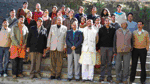
 Participants and Resource Persons
In the first half of the third day, the participants did hands-on in ERDAS (Earth Resource Data Analysis System) GIS software in the Remote Sensing lab of the Centre and learned how to register the image? and how to transfer real word data into the computer through digitization of point, line and polygon data. The participants in the lab were assisted by Mr. Manish Kumar, lecturer in GI Science and Technology in the Centre. In the second half of the third day, Dr. H B Madhwal, Ex. Director , Survey of India, Dehradun, presented a detailed account of GPS technology and its applications in different fields, i.e., surveying, mapping, monitoring and navigation etc.
On the fourth day participants did hands on through GPS in field and lab.
In the first half of the day, the participant are distributed in to 10 different groups (2 members in each group) to prepare rout map of a given track. Each group prepare a rout map and captured data (i.e. latitude/longitude and height) of different places along the given rout. Each group was assisted by a GPS surveyor.
In the second half of the fourth day, the participant downloaded the rout map from GPS to computer and learn map editing in the GIS lab of the. In the map editing work they assisted by Miss Neetu Gill, lecturer in GI Science and Technology of this centre.
Using the data input from remote sensing and GPS technologies, how to prepare GIS (Geographic Information System) ? – the fifth day was completely for learning GIS. Mr. R Gupta, Delhi school of Economics, University of Delhi delivered lecture on basics of GIS which include definition, concept, history and components of GIS. Mr. Gupta also demonstrated applications of GI Science in town planning, agriculture planning, marketing, agriculture products, road planning and in identifying urban heat islands.
In the second half of the day the participants did hands-on in the Arc-View software in the GIS lab with the technical assistance of the Centre’s personnel.
On the sixth day, a demonstration was given to the participant on computer mapping through Gram++ ( a very low cost GIS Software, developed by the Department of Science and Technology Government of India through CSRE,IIT Mumbai) by Prof. J S Rawat, and through Arc-View by Mr. Manish Kumar. In the second half of the sixth day, the participant did hands-on in computer mapping through Gram++ and Arc-View GIS Software. They were assisted by Mr. Vinod Singh Rawat, Scientist and Miss Nitu Gill, Lecturer of the Centre.
On the seventh day, feedback from the participants was taken and Valedictory ceremony was celebrated. In the feedback session, the participants did appreciate to this pioneer attempt of eye opening training workshop on GI Science and Technology for University and College teachers. The participants also appreciated the training workshop material in the form of a booklet, viz., “Geographic Information Science and Technology for the Beginner” (Rawat et al 2011) provided to them by the Centre. Based on the deliberations in the feedback session, the following recommendations emerged:
— The period of training programme on GI Science for the beginners should be for a period of minimum 15 days and about fifty percent of the training period should be for hands-on training.
— The training workshops on GI Science for the beginners should be organized twice a year for teachers as well as for officers of different government departments.
— Subject wise (such as botany, geology, hydrology, geomorphology, meteorology, archeology, forestry, sociology, economics, biotechnology, agriculture, commerce and management etc.), training programmes on applications GI Science and Technology should be organized.
— Training programme on handling specific GIS Software such as Arc View/ERDAS/ GRAM++/ Geomatica , and of GPS should be organized separately.
— Advanced training programmes having a minimum period of one month should be organized for those participants who have successfully completed the course on GI Science for the Beginners.
— Orientation course on applications of GI Science in planning, administration, resource management, monitoring and decision making should be organized for district and state level government officers.
— For making use of this newly emerging discipline M.A. /M.Sc programme on GI Science and Technology should be started by all the Indian Universities (visit www.coenrdmsalmora.org for the syllabus of GI Science and Technology designed by the Kumaun University with the financial and technical support of the DST, Government of India).
— For making wise use of GI Science and Technology in administration, planning and development, in near future, this subject should be included in education right from the high school level to develop fully educated and skilled human resource in this discipline.
— The state government should establish GIS cell at the headquarter of each district for developing and updating Geographic Information System the district for efficient and transparent administration, planning and monitoring of development activities.
In the valedictory session, Padamsri (Dr.) Lalit Pandey, Director, Uttarakhand Sewa Nidhi, Jakhan Devi Almora said that it is very interesting subject for getting information quickly and provoked the participants to make use of this newly emerging science in the rural development of India.
At the end. Prof J.S.Rawat, the Coordinator of the workshop, extended vote of thanks to the all.
—————————————————-
Dr. J.S.Rawat – Director, Centre of Excellence for NRDMS in Uttarakhand (under the DST Government of India) & Professor in Geography, Department of Geography, Kumaun University, SSJ Campus Almora-263601, Uttarakhand, India
Reference Cited
Wilson, J.P. and Fotheringham, A.S. (2008): The Handbook of Geographic Information Science (eds.)Wilson, J.P. and Fotheringham, A.S. Blackwell Publishing, USA, pp. 1-634.
Rawat, J.S. (2011); Geographic Information Science and Technology for the Beginner, (ed. ) Rawat. J.S., Centre of Excellence for NRDMS in Uttarakhand, Department of Geography, Kumaun University SSJ Campus Almora, pp.1-59.
