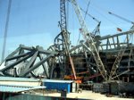

“Singapore’s construction demand may grow as much as 9 percent to S$28 billion ($21.6 billion) in 2011 from a year earlier as new government-funded projects offset an expected slowdown in private sector demand, a state agency said.”
Vietnam is experiencing rapid growth in the transportation sector.”The Southeast Asian country needs US$16 billion for transport infrastructure projects a year; however, it can afford half of that figure. Earlier, Vietnam’s National Assembly, the country’s highest legislative body, approved a plan to allocate VND72.22 trillion for local infrastructure projects in 2011,” reports Vietnam Business News.
As this period of growth continues, there is also further building out of the broadband networks in many countries, thus enabling many geomatics technologies to be more fully engaged in mainstream infrastructure projects, particularly those connecting field data operations together with online web services.
An example of this type of connection can be seen this week with the recent announcement of a new field controller for field data collection. “Optimized for use with Trimble Access field software, the TSC3 controller delivers more capable data collection, computing and connectivity. A range of new features and functions provide the benefits of multiple devices into a single handheld: a digital camera, integrated communications as well as a GPS navigator, compass and accelerometer. Now surveyors can easily include on-site photos in surveys, communicate more efficiently between field and office and streamline stakeout activities.”
As rapid infrastructure growth takes place, the demands for implementing fully digital operations, thus increasing efficiencies and supporting the full lifecycle of infrastructure projects is rapidly becoming the norm. Research and Markets see’s a growth rate of 23-28% in GNSS Machine Control up to 2012.
Upon hearing of these high rates of growth for the first time, many people associate them with actual construction processes and sometimes dismiss the broader downstream technology links that integrate GNSS, GIS, CAD and other geomatics technologies like laser scanning, aerial photography, lidar and communication technologies into these development projects.
At the present rate of Asian growth, and considering the current populations and demographics that would be involved, these regions are likely to experience a level of investment (purchasing) that out distances those we have seen anywhere to date. In addition, agriculture, disaster and relief, maritime, mining, forestry and other sectors will see similar rates of growth.