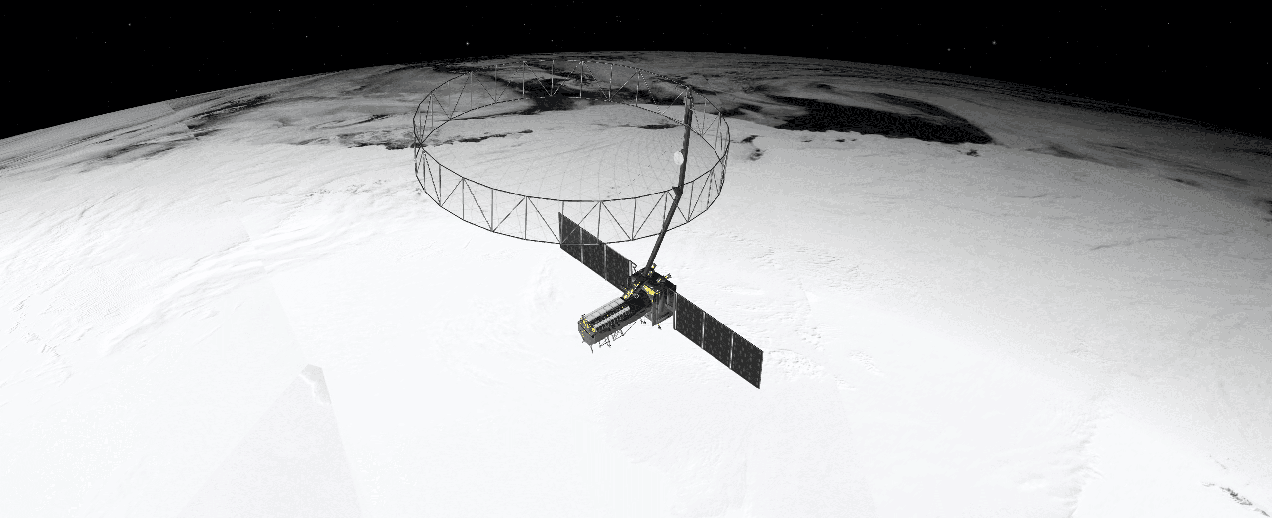
When NASA and the Indian Space Research Organization’s (ISRO) new Earth satellite NISAR (NASA-ISRO Synthetic Aperture Radar) launches in coming months, it will capture images of Earth’s surface so detailed they will show how much small plots of land and ice are moving, down to fractions of an inch. Imaging nearly all of Earth’s solid surfaces twice every 12 days, it will see the flex of Earth’s crust before and after natural disasters such as earthquakes; it will monitor the motion of glaciers and ice sheets; and it will track ecosystem changes, including forest growth and deforestation. The spacecraft, depicted here in an artist’s concept, will launch from India.
The mission’s extraordinary capabilities come from the technique noted in its name: synthetic aperture radar (SAR). Pioneered by NASA for use in space, SAR combines multiple measurements, taken as a radar flies overhead, to sharpen the scene below. It works like conventional radar, which uses microwaves to detect distant surfaces and objects, but steps up the data processing to reveal properties and characteristics at high resolution.
To get such detail without SAR, radar satellites would need antennas too enormous to launch, much less operate. At 39 feet (12 meters) wide when deployed, NISAR’s radar antenna reflector is as wide as a city bus is long. Yet it would have to be 12 miles (19 kilometers) in diameter for the mission’s L-band instrument, using traditional radar techniques, to image pixels of Earth down to 30 feet (10 meters) across.
Image Credit: NASA/JPL-Caltech
