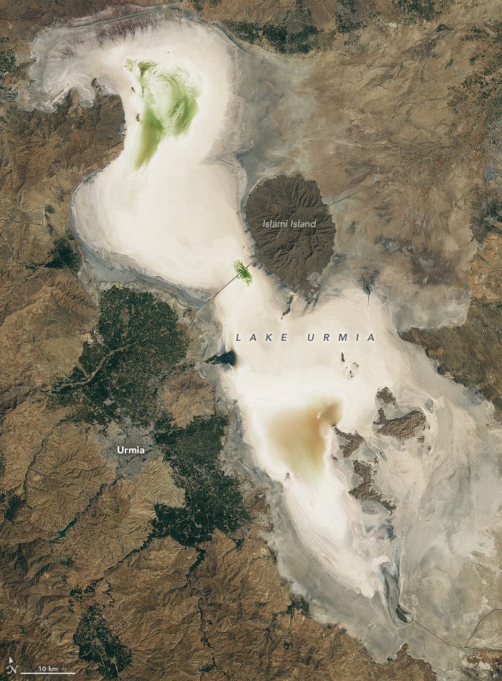
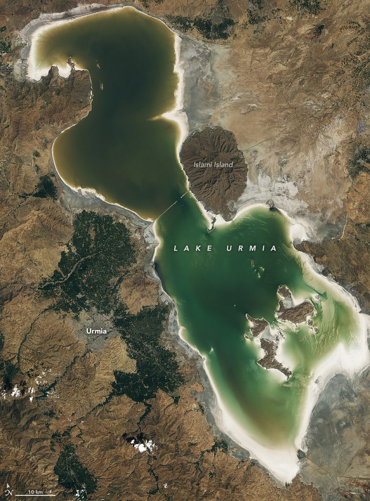
 After rapidly growing in volume just a few years earlier, northwest Iran’s Lake Urmia nearly dried out in autumn 2023. The largest lake in the Middle East and one of the largest hypersaline lakes on Earth at its greatest extent, Lake Urmia has for the most part transformed into a vast, dry salt flat.
On Sept. 7, 2023, the OLI-2 (Operational Land Imager-2) on Landsat 9 captured this image (top) of the desiccated lakebed. It stands in contrast to the image from three years earlier (bottom), acquired by the OLI on Landsat 8 on Sept. 8, 2020, when water filled most of the basin and salt deposits were only visible around the perimeter of the lake. The replenishment followed a period of above-average precipitation that sent a surge of freshwater into the basin, expanding its watery footprint. Drier conditions have since brought levels back down.
Image Credit: NASA Earth Observatory images by Lauren Dauphin, using Landsat data from the U.S. Geological Survey
