Asian Surveying & Mapping
Breaking News
South Korea is converting an abandoned coal mine into a moon exploration testing ground
South Korea is transforming abandoned coal mines into testing...
ISRO to Launch Chandrayaan-5 With Japan, Plans Space Station
Dr. V. Narayanan, Chairman of the Indian Space Research...
Russia and China are threatening SpaceX’s Starlink satellite constellation, new report finds
SpaceX's Starlink satellite constellation is facing threats from Russia...
China and Pakistan agree to fly 1st foreign astronaut to Chinese space station
For the first time, the Chinese space program will train...
ISRO’s “Space on Wheels” offers a peek into Indian Space Programme to students in Karimnagar
The Indian Space Research Organisation (ISRO)’s “Space on Wheels”...
Geospatial led solutions build the foundations for better decision-making
Geo Connect Asia 2025 paves the way for turning...
GEOSA, Singapore Land Authority Launch Achievements of Joint Geospatial System Project
Riyadh, SPA -- The General Authority for Survey and...
Building in Bangkok collapses as powerful earthquake hits southeast Asia
One person has died and 50 were injured in...
Bellatrix Aerospace Partners with Astroscale Japan for Space Debris Removal
Bellatrix Aerospace, a Bengaluru-based space mobility company, has joined...
NSTC announces Pingtung site as Taiwan’s space mission launch center
Taipei, March 26 (CNA) Taiwan's National Science and Technology...
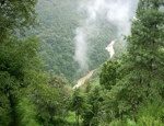
Forest-in-Bhutan

The training and collaboration in remote sensing for improved management of forests and wildlife has been ongoing for the past two years, with support from the U.S. Department of State and the U.S. Agency for International Development. The U.S. Forest Service employees are helping the Bhutanese develop geospatial data from remote sensing imagery of historical wildfires and current tree canopy cover.

Since mid-February, Bhutanese foresters Kinley Tshering and Phub Dhendup, both from the Bhutan’s Ministry of Agriculture and Forests, Department of Parks and Forests, are spending most of their time at the Forest Service’s Remote Sensing Applications Center in Salt Lake City. Near the end of their training, they will spend a week in Missoula, Mont. visiting the Forest Service’s Missoula Fire Sciences Laboratory, Northern Regional Office and the University of Montana, Department of Forest Management.

The Forest Service has been sharing decision support tools, such as forest fire history mapping, with South Asian countries like Bhutan for decades. The burn history data comes from the interpretation of satellite imagery along with field inventory efforts. With details on historical fires, and an updated tree inventory, the country is equipped to assess their forest carbon stores.

Source: U.S. Forest Service