Asian Surveying & Mapping
Breaking News
Australia and UK tie up for navigation without GNSS
Airborne navigation without GNSS is the aim of a...
Market size, technical gaps threaten Taiwan’s space dream
As global players like SpaceX dominate headlines, Taiwan is...
China quietly tested its first inflatable space module in orbit
BREMEN, Germany — China tested out a small expandable...
Isro Signs Agreement with Australian Space Agency for Gaganyaan Mission
Isro Signs Agreement with Australian Space Agency for Gaganyaan...
ESA and Japan expand collaboration in space exploration
The European Space Agency (ESA) and the Japan Aerospace...
Korea’s space development to hit wall without private sector initiative
The private sector should take the initiative in South...
India’s Chandrayaan-2 moon orbiter avoids collision with South Korea’s Danuri spacecraft
India's Chandrayaan-2 moon orbiter maneuvered in September to avoid...
Dubai residents may soon have opportunity to travel to the edge of space
Residents of Dubai may soon have the chance to...
Swift Navigation and KDDI Launch Skylark Precise Positioning Service Across Japan
SAN FRANCISCO and TOKYO - Swift Navigation, a global...
Thailand plays host to Southeast Asia’s largest space technology event
Thailand Space Week 2024, the region’s premier international space...

Ever since the uninhabited volcanic island Hunga Tonga-Hunga Ha‘apai exploded in mid-January 2022, the people of Tonga have faced a gauntlet of hazards.

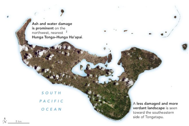
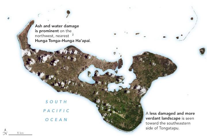
One of the most widespread is volcanic ash. Satellite images collected in the days after the eruption show the fine-grained shards of pulverized rock covering several islands, turning land surfaces from lush green to tan and gray. On Jan. 25, 2022, the Operational Land Imager (OLI) on Landsat 8 captured an image of ash coating much of Tongatapu, Tonga’s most-populous island. (The full scene is available for download.)

According to the United Nations, an average of 2 centimeters of ash coated surfaces in the island nation’s capital city after the eruption. While the extent of damage from the ashfall is still being assessed, preliminary reports indicate that it has contaminated drinking water, disrupted transportation networks and likely damaged crops.

Image Credit: NASA Earth Observatory images by Joshua Stevens, using Landsat data from the U.S. Geological Survey and ALOS-2 data from the Japan Aerospace Exploration Agency/JAXAand the Earth Observatory of Singapore Remote Sensing Lab.