Asian Surveying & Mapping
Breaking News
South Korea is converting an abandoned coal mine into a moon exploration testing ground
South Korea is transforming abandoned coal mines into testing...
ISRO to Launch Chandrayaan-5 With Japan, Plans Space Station
Dr. V. Narayanan, Chairman of the Indian Space Research...
Russia and China are threatening SpaceX’s Starlink satellite constellation, new report finds
SpaceX's Starlink satellite constellation is facing threats from Russia...
China and Pakistan agree to fly 1st foreign astronaut to Chinese space station
For the first time, the Chinese space program will train...
ISRO’s “Space on Wheels” offers a peek into Indian Space Programme to students in Karimnagar
The Indian Space Research Organisation (ISRO)’s “Space on Wheels”...
Geospatial led solutions build the foundations for better decision-making
Geo Connect Asia 2025 paves the way for turning...
GEOSA, Singapore Land Authority Launch Achievements of Joint Geospatial System Project
Riyadh, SPA -- The General Authority for Survey and...
Building in Bangkok collapses as powerful earthquake hits southeast Asia
One person has died and 50 were injured in...
Bellatrix Aerospace Partners with Astroscale Japan for Space Debris Removal
Bellatrix Aerospace, a Bengaluru-based space mobility company, has joined...
NSTC announces Pingtung site as Taiwan’s space mission launch center
Taipei, March 26 (CNA) Taiwan's National Science and Technology...

March 9th, 2021
Deforestation in Papua

image

Although it covers just 1 percent of Earth’s land surfaces, Indonesia’s rainforest is believed to shelter 10 percent of the world’s known plant species, 12 percent of mammal species and 17 percent of bird species. Spread across 18,000 islands, it covers an area large enough to make it the world’s third-largest rainforest, trailing only those in the Amazon and Congo basins.

While satellite data indicate that Indonesia has had high rates of forest loss in recent decades, the situation seems to be changing. Deforestation declined significantly between 2017-2019, according to data from Global Forest Watch. The forest change data used in the analysis was collected by Landsat satellites and processed by a team from the University of Maryland.

But even as deforestation slows on major Indonesian islands such as Sumatra and Kalimantan, there are signs of a shift to other areas. One of those areas is Papua (also called Western New Guinea). Papua’s rugged terrain and scarcity of transportation infrastructure has led to less development and economic growth than in other parts of Indonesia. But in some parts of the island, there has been noticeable new activity in the past decade.

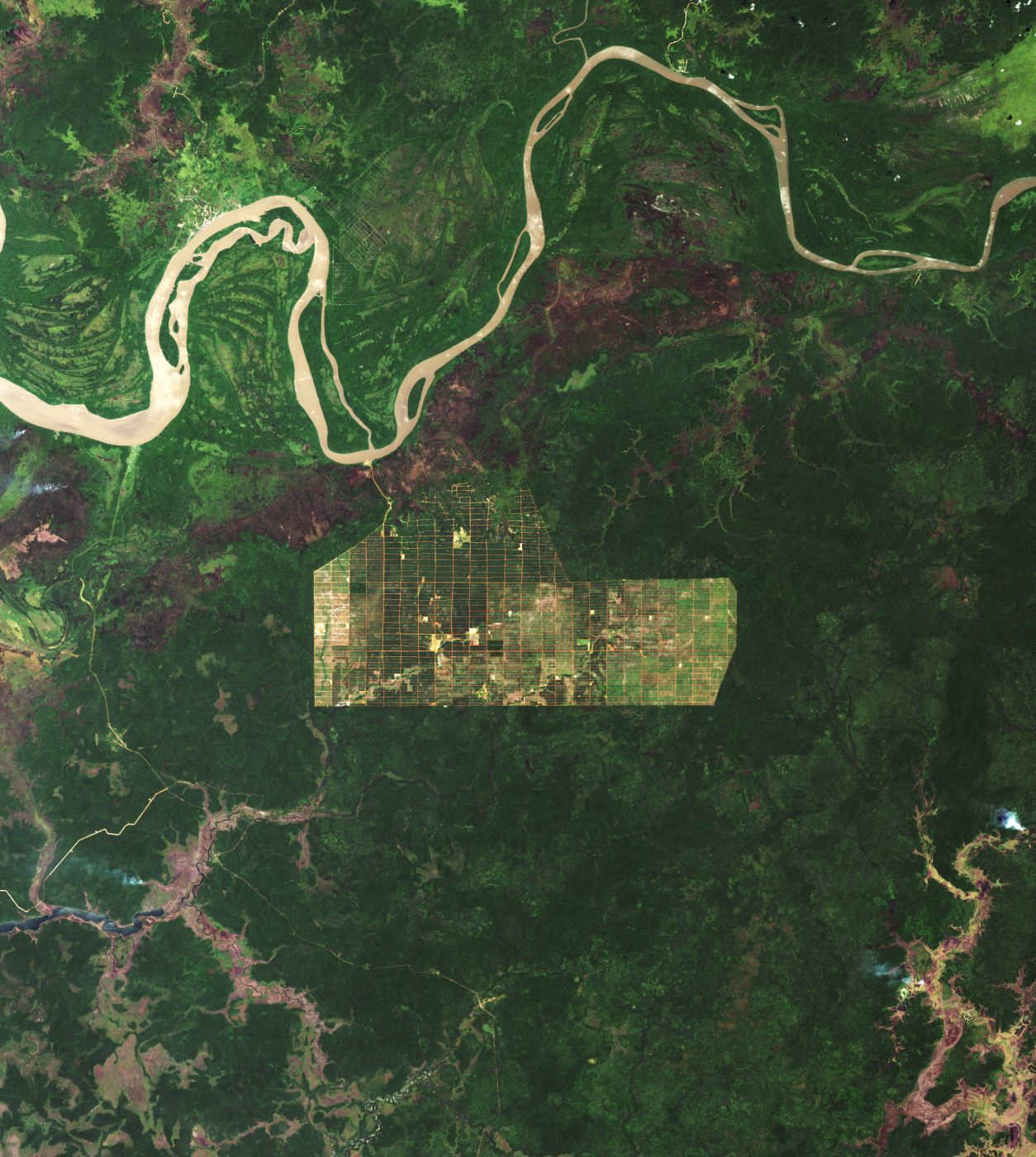
The accompanying image shows forest clearing along the Digul River near Banamepe, an area that was cleared between 2011 and 2016. The data was acquired by the Operational Land Imager (OLI) on Landsat 8 in 2020.