Asian Surveying & Mapping
Breaking News
South Korea is converting an abandoned coal mine into a moon exploration testing ground
South Korea is transforming abandoned coal mines into testing...
ISRO to Launch Chandrayaan-5 With Japan, Plans Space Station
Dr. V. Narayanan, Chairman of the Indian Space Research...
Russia and China are threatening SpaceX’s Starlink satellite constellation, new report finds
SpaceX's Starlink satellite constellation is facing threats from Russia...
China and Pakistan agree to fly 1st foreign astronaut to Chinese space station
For the first time, the Chinese space program will train...
ISRO’s “Space on Wheels” offers a peek into Indian Space Programme to students in Karimnagar
The Indian Space Research Organisation (ISRO)’s “Space on Wheels”...
Geospatial led solutions build the foundations for better decision-making
Geo Connect Asia 2025 paves the way for turning...
GEOSA, Singapore Land Authority Launch Achievements of Joint Geospatial System Project
Riyadh, SPA -- The General Authority for Survey and...
Building in Bangkok collapses as powerful earthquake hits southeast Asia
One person has died and 50 were injured in...
Bellatrix Aerospace Partners with Astroscale Japan for Space Debris Removal
Bellatrix Aerospace, a Bengaluru-based space mobility company, has joined...
NSTC announces Pingtung site as Taiwan’s space mission launch center
Taipei, March 26 (CNA) Taiwan's National Science and Technology...
  • Feb 18, 2020
  • Comments Off on Satellite Image Data Reveals Rapid Decline of China’s Intertidal Wetlands
  • Feature
  • 904 Views

Using archives of satellite imaging data, a study in Frontiers in Earth Science has conducted the most in-depth study of China’s intertidal wetlands to date and found a 37.62% decrease in area between 1970 and 2015.

Intertidal wetlands significantly contribute to China’s environmental and ecological diversity, but are facing unprecedented pressures from anthropogenic development, as well as the threat of future sea level rise.

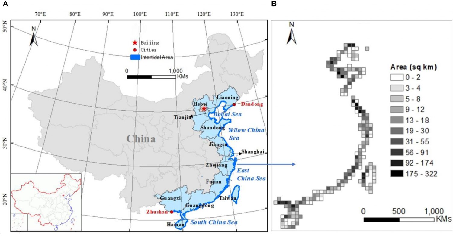
The location of the Chinese intertidal zone (A) and its area distribution at 50-kilometer resolution (B). The location and distribution map are based on 2015 data.

Despite the ecological and economic significance of China’s vast areas of intertidal wetlands, such as storm protection, pollution purification and carbon sequestration, their distribution and variation over time have not been well documented. This study highlights the urgency for conservation measures of these valuable habitats by showing the scale of their decline for the first time.