Asian Surveying & Mapping
Breaking News
Saudi: GEOSA and RIPC sign deal to enhance the role of Geospatial Data in infrastructure projects
Riyadh: The General Authority for Survey and Geospatial Information...
World’s largest solar project will send Australian energy to Singapore
In August, Australia’s environment minister Tanya Plibersek approved the...
India’s Drone Market to Skyrocket with 44.2% CAGR by 2029, Driven by Aatmanirbhar Bharat Initiative
India is witnessing a technological revolution because it is...
China unveils lunar spacesuit for crewed moon mission
HELSINKI — China’s human spaceflight agency has revealed the...
China launches first reusable satellite, with payloads from Thailand and Pakistan
China on Friday successfully launched its first reusable satellite...
Chandrayaan-3 landed on possibly oldest craters of Moon, say researchers
India's lunar mission Chandrayaan-3 possibly landed in one of...
China sets historic Mars mission for 2028 as US plan remains in limbo
China is on track to launch its Tianwen-3 mission...
GNSS: Here’s how India’s new GPS-based toll system will change your highway travel
The Ministry of Road Transport and Highways has revised...
Shanghai Is Hit by Strongest Typhoon in Decades and Comes to a Standstill
Typhoon Bebinca, the strongest storm to hit Shanghai since...
Iran launches research satellite into orbit
TEHRAN: Iran on Saturday blasted a new research satellite...
  • Jul 30, 2019
  • Comments Off on Researchers from University of Adelaide Win Global Pose Estimation Challenge
  • Feature
  • 857 Views

The team of researchers from the University of Adelaide’s Australian Institute for Machine Learning (AILM) defeated 47 other universities and space technology companies at the international space competition hosted by the European Space Agency.

The South Australian team—including Associate Professor Tat-Jun Chin, Dr. Bo Chen and Dr. Alvaro Parra Bustos—won the challenge to determine the most accurate orientation of an object in space by using machine learning and 3D vision algorithms.

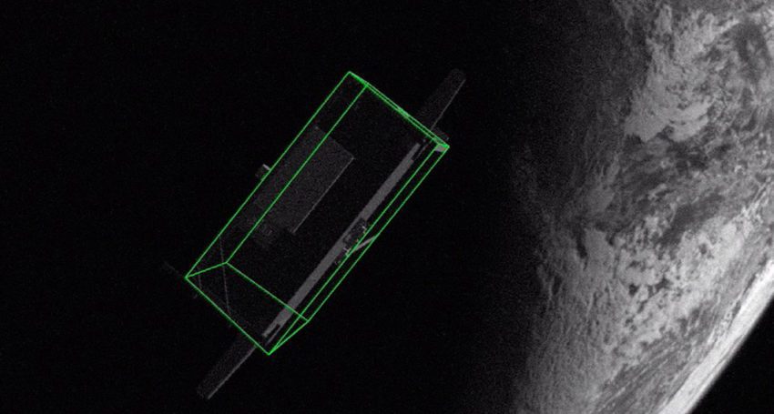
Teams were given individual high-fidelity images of the Tango spacecraft from the 2016 PRISMA mission and were required to determine the orientation of the craft in relation to the observer from close rendezvous.

The goal of the challenge was to estimate the pose—the relative position and attitude—of a known spacecraft in order to help future space missions.

Knowing the exact pose enables the development of debris-removal technologies, refurbishment of expensive space assets, and the development of space depots to facilitate travel toward distant destinations.