Asian Surveying & Mapping
Breaking News
Australian Space Agency funds development of aerospace-grade GNSS receiver
The Australian Space Agency has funded the development of...
Continuity risks for Australian EO data access
A new report details the widespread use of Earth...
China launches new remote sensing satellite
JIUQUAN, April 15 (Xinhua) -- China on Monday launched...
7.4-Magnitude Earthquake Strikes Taiwan
A major, 7.4-magnitude earthquake struck the eastern coast of...
Tata Deploys Its Geospatial Satellite In Space on Space X’s Falcon 9 Rocket
THIRUVANANTHAPURAM: Tata Company launched India's first private commercial satellite...
Taiwan’s Formosat-8 Satellite Set for Launch by 2025
The Taiwan Space Agency has announced progress on the...
Iranian Scientists to Build Satellite Constellation for 2 Simultaneous Missions
The scientists at the knowledge-based company had previously succeeded...
China provides geospatial intel and other military support to Russia, US says
The US has warned its European allies that China...
Japanese lunar lander company ispace raises $53.5 million in stock sale
WASHINGTON — Japanese lunar lander developer has raised $53.5...
Esri and Prince Sultan University Advance GIS Education Through Strategic Partnership
Memorandum of Understanding with Institution Enhances GIS Curriculum and...

A defunct Chinese space station plummeted through Earth’s atmosphere on April 1, 2018, and officials said debris from the 18,000-pound spacecraft landed in the Pacific Ocean.

In a statement, U.S. military officials said the Tiangong-1 space station reentered the atmosphere at 8:16 p.m. ET.

Whatever remained of the craft fell in the South Pacific, between California and Hawaii — “out in the middle of nowhere, which is exactly where we hoped it would land,” said Roger Thompson, a senior engineering specialist with Aerospace Corp. of El Segundo, Calif., which works closely with NASA and has been tracking the space station since 2016.

If someone had been in a nearby ship, he or she would have seen the estimated 10 percent to 40 percent of Tiangong-1 that likely survived re-entry careening through the sky, on fire and still in formation, Thompson said.

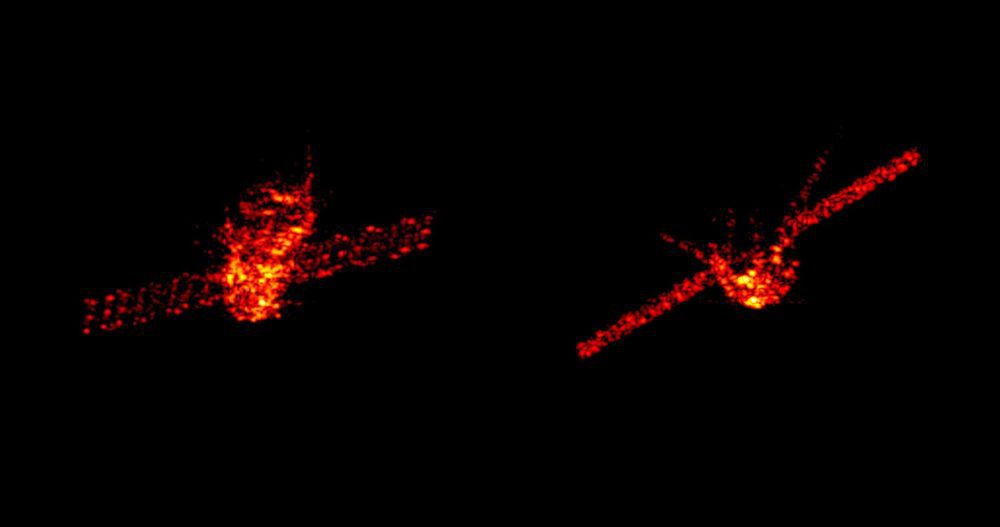
These radar images were acquired by the Tracking and Imaging Radar system operated by Germany’s Fraunhofer FHR research institute at Wachtberg, near Bonn, when the craft was at an altitude of about 270 kilometers.

“It would look like several dozen comets that were streaming along,” he told NBC News. Gradually, the pieces would spread out and plunge into the water.