Asian Surveying & Mapping
Breaking News
Japan Eyes Sovereign D2D Satellite Network
Japan plans to select a proposal this month for...
China schedules Long March 10B rocket launch and recovery attempt
HELSINKI — China is set for a debut flight...
BRICS space agencies meet begins in Bengaluru
Heads and senior representatives of the space agencies of...
“India’s growing space ecosystem to drive global collaboration”, says ISRO Chairman V Narayanan after BRICS Space Agencies Meeting
"India's growing space ecosystem to drive global collaboration", says...
UAE aims to see Emirati on Moon in next 10 years, says MBRSC chief
UAE expects to have a presence on the Moon within...
Safran, SatSure partner to develop geospatial intelligence solutions for India
French aerospace giant Safran Electronics & Defense and Indian...
Singapore unveils road map to help develop international business standards and conformance
Singapore has unveiled plans to help develop international standards...
Adelaide University to run space and defence venture launchpad ahead of Australian Space Forum
Adelaide University’s Innovation & Collaboration Centre (ICC) will deliver...
Japan’s H3 rocket returns to space with successful launch after December setback
Japan’s flagship H3 rocket has returned to flight six...
KONGSBERG accelerates seabed mapping developments with Ocean Exploration Trust expedition aboard Exploration Vessel Nautilus
KONGSBERG and the Ocean Exploration Trust (OET) are set...

November 27th, 2017
Satellite Views Severe Rain Storms Over Western Saudi Arabia

NASA’s Global Precipitation Measurement Mission (GPM) core satellite analyzed severe storms that moved into Jeddah, Saudi Arabia, on Nov. 21, 2017. Heavy downpours caused schools and universities to close, and the General Authority of Meteorology and Environment Protection predicted that heavy rain will continue for a couple days.

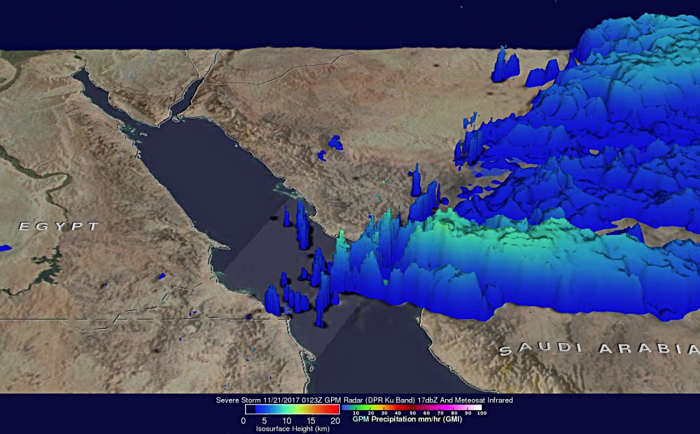
At NASA’s Goddard Space Flight Center in Greenbelt, Md., GPM data were used to create a 3D view of precipitation of the storms over western Saudi Arabia, showing that a few storm tops over the Red Sea were reaching heights above 10 kilometers (6.2 miles).


Photo Credit: NASA/JAXA, Hal Pierce