Thursday, June 16th, 2011
A new video tutorial, entitled Predicting Land Cover Change with Land Change Modeler, is now available on the Clark Labs' website. Land Change Modeler utilizes land cover maps of two dates to evaluate historic changes.
Thursday, June 9th, 2011
SuperGeo Technologies announced that its exclusive partner in Italy, Helix S.r.l., has successfully promoted the Helix Mobile Mapping System (HMMs) to Regione Marche for civil protection and spatial data collection. Regione Marche is a regional government sector...
Thursday, June 9th, 2011
Trimble introduced today Trimble RealWorks version 7.0, the first commercially available software suite that incorporates the newly approved ASTM International E57 E2807 data exchange standard for 3D imaging systems. Trimble RealWorks version 7.0 allows 3D laser scanning professionals...
Thursday, June 9th, 2011
Altium has announced the release of the Altium Satellite Vault server application, a core element of Altium's advanced electronics design data management technology and a major innovation in connecting the world of design to the broader product...
Thursday, June 9th, 2011
Intergraph CADWorx Plant Design Suite 2012, the newest version of Intergraph’s design solution for mid-market and AutoCAD-based projects and workgroups, is now compatible with AutoCAD 2012, the latest AutoCAD release from Autodesk, offering users improved capabilities.
Wednesday, June 8th, 2011
Petrovietnam Marine Shipyard Joint Stock Company (PV Shipyard) has standardized on Intergraph SmartMarine 3D as its preferred 3D offshore engineering and design solution. PV Shipyard has also expanded its portfolio of Intergraph solutions and has selected other...
Wednesday, June 8th, 2011
Spectral Imaging, Ltd., announces that it has successfully delivered the world’s most compact, high-performance Long-Wave Infrared, LWIR Hyperspectral Imager to a Defence Customer in a strategic geographical location. The advanced chemical imaging capabilities will bring a new dimension...

Tuesday, May 31st, 2011
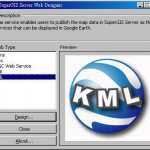
SuperGeo Technologies announced that SuperGIS Server 3 supports KML (Keyhole Markup Language) map service publishing and assists enterprises in improving map sharing and display performance.
Tuesday, May 31st, 2011
Agency9, the leading provider of web based 3D solutions, today released their cloud service CityPlanner 2.0 internationally. Agency9 CityPlanner is a web service that empowers project managers, planners and architects to visualise and interact with 3D models...