
Tuesday, March 8th, 2011
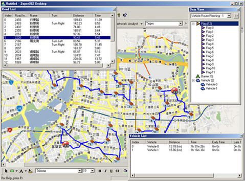
Officially released in February 2011, SuperNetObjects 3 contains a wide range of network analysis functions for developers to undertake powerful applications. The operation and the objects this brand-new SuperNetObjects 3 provides greatly surpass its previous version, SuperNetObjects...
Thursday, March 3rd, 2011
Bentley Systems, Incorporate today introduced, during its first Annual Corporate Update conference call, an innovative new “sustainable licensing” business model based on annual Portfolio Balancing. With this industry milestone, users no longer need to settle for software...
Wednesday, March 2nd, 2011
PCI Geomatics today announced that the company has been awarded a contract valued at over $520,000 (CAD) through the Canadian Space Agency's Earth Observation Applications Development Program (EOADP). PCI fulfillment...
Wednesday, March 2nd, 2011
Autodesk, Inc. announced the release of Autodesk 3ds Max 2012 software, the latest version of the company’s 3D modeling, animation, rendering and compositing application. Mapping to the Excalibur (XBR) initiative — a phased plan for the restructuring...
Monday, February 28th, 2011
Is your GIS ready for Gov 2.0? The results of Esri Australia’s Gov 2.0 Benchmark Study are in. According to local governments, Gov 2.0 is here to stay, and GIS will play a key role in enabling...
Wednesday, February 23rd, 2011
Safe Software, the global leader in spatial data transformation, announced today the kick-off of the FME 2011 World Tour, a customer event series that will be held in 25+ cities worldwide starting this March. Co-hosted with Safe...
Tuesday, February 22nd, 2011
SuperGeo announces that the latest network objects—SuperNetObjects 3 is officially released worldwide. SuperNetObjects 3 is a component library based on network objects, enabling developers to design various network analysis functions. SuperNetObjects 3 supports developers to apply program languages,...
Tuesday, February 22nd, 2011
SuperGeo Technologies, the leading global provider of complete GIS software and solutions, announced its new reseller, GeoViet Consulting, in South-east Asia. GeoViet Consulting will distribute SuperGIS series software in Vietnam. GeoViet Consulting is located in Hanoi, the capital...
Tuesday, February 22nd, 2011
Spatial Information Solutions, Inc. (SIS) announces the release of version 3.0 of its flagship software product, Accuracy Analyst™. SIS has received invaluable feedback from many of its supportive customers and has used that advice to add more...