Asian Surveying & Mapping
Breaking News
HAL to build, market Isro’s SSLV in landmark deal
New Delhi, Jun 20: In a historic move for...
Taiwan developing space capabilities for all-weather imaging
TAIPEI (TVBS News) — Taiwan is advancing its space...
Honda hails successful test of reusable rocket as it looks to get into the space business
Tokyo — Japan's second-biggest carmaker, Honda, has successfully tested...
China’s space program provides larger platform for broader international cooperation
BEIJING -- Experts from China's manned space program said...
India To Launch $1.5 Billion Joint Earth Mission With NASA In July
National Aeronautics and Space Administration (NASA) and the Indian...
Axiom-4 mission delayed again: ISRO confirms Subhanshu Shukla’s ISS spaceflight won’t launch before 22 June 2025
The Axiom-4 mission to the International Space Station has...
Mengzhou spacecraft for China’s moon-landing mission passes landmark test flight
China has completed the inaugural test flight of its...
Space application for ITMA Asia + CITME 2026 opens
Shanghai – Space application for the 2026 edition of...
Yanmar, Chia Tai and XAG Empower Thai Agriculture through Innovation
Bang Nam Priao District, Chachoengsao Province, Thailand – On...
bitsensing Signs MOU with IKIO Technologies to Advance AI-Based Traffic Monitoring on India’s Expressways, Highways and Municipal Areas
Backed by proven success in South Korea and Europe,...

Software

image

Wednesday, May 11th, 2011

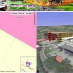
SuperWebGIS Designs Eco-cultural Web-GIS for Environment Navigation

SuperGeo Technologies, the leading global provider of complete GIS software and solutions, designed an Eco-cultural GIS website for Tungnan University to integrate the campus navigation system with the information of surrounding environment, ecology and culture. Aimed to...

Wednesday, May 11th, 2011

New CorelCAD Delivers Precision and Power at an Affordable Price

Corel today announced the expansion of its award-winning graphics and technical illustration portfolio with the introduction of CorelCAD, a powerful and affordable CAD solution that delivers native DWG (industry standard CAD file format) support, and the ability...

Tuesday, May 10th, 2011

CHC Introduces New GPS Mapping Solutions

CHC today announced the availability of Nava GPS Handheld series designed for any meter-level GPS mapping applications such as in forestry, agriculture, utilities, and local government, which are mainly capturing data about assets. Nava GPS are affordable, easy-to-use...

Monday, May 9th, 2011

Feature-level Security for ArcGIS Server

con terra GmbH, one of the market leader in providing solutions for Spatial Data Infrastructures and Enterprise GIS, announces a new release of the long-established securityManager, now with support for feature-level security on ArcGIS...

Sunday, May 8th, 2011

Marine Expert iXSurvey Chooses MrSID

iXSurvey is a multinational company with offices in Australia, France and the UK that specialises in the measurement and understanding of the physical, chemical and biological marine environment. The company’s experienced and talented team of surveyors carries...

Thursday, May 5th, 2011

GRAPHISOFT Announces ArchiCAD 15

GRAPHISOFT announced today ArchiCAD 15, the latest version of its premium design software for architects. ArchiCAD 15 enriches architectural forms available for designers to unleash their creative minds. The new version also expands the scope of the BIM...

Tuesday, May 3rd, 2011

SuperGIS Server 3 to Support Map Cache

SuperGeo Technologies announced that its SuperGIS Server 3 is going to support the map cache function soon for speedy map processing functionality. Developed by SuperGeo Technologies, SuperGIS Server 3, the map server software, enables enterprises to create, manage, integrate, and...

Tuesday, May 3rd, 2011

Newforma Delivers Common Platform to Architects, Engineers and Contractors

Newforma project information management software company for architecture, engineering and construction firms worldwide, today announced the results of final product acceptance testing of its new solution for comprehensive contract and document change management, Newforma Contract Management.

Tuesday, April 26th, 2011

SuperGeo Releases Mobile Cadastral GIS 3.0

SuperGeo Technologies announces that Mobile Cadastral GIS 3.0 is officially released to assist efficient cadastral navigation measuring and field survey.  Mobile Cadastral GIS is designed for cadastral navigation measuring and field survey on the basis...

Sunday, April 24th, 2011

Bentley – Two-Way Interoperability With ISO 15926

Commenting on the FIATECH demonstration, Ken Adamson, Bentley vice president, Electrical, Piping, and Plant, said, “With our OpenPlant products, which natively use the ISO 15926 reference data, we have always had the capability to empower two-way, real-time...

Page 168 of 175 1 163 164 165 166 167 168 169 170 171 172 173 175