Asian Surveying & Mapping
Breaking News
Australia’s Gilmour Space Technologies ready to launch maiden Eris Test flight the nation’s first orbital launch in over 50 years
Gilmour Space Technologies is the leading launch services company...
Korea’s space agency seeks revision of plan to modify next-gen rockets into reusable system
South Korea's aerospace agency said on Thursday that it...
UAE Space Agency Signs Agreement With Technology Innovation Institute to Execute the Emirates Mission to the Asteroid Belt’s Lander Project
In the presence of His Highness Sheikh Hamdan bin...
Private Japanese lunar lander enters orbit around moon ahead of a June touchdown
A private lunar lander from Japan is now circling the moon, with...
Indian astronaut to travel soon to ISS as part of ISRO-NASA Mission
Prime Minister Narendra Modi said by 2040, an Indian’s...
China issues regulatory framework to support direct-to-device satellite services
HELSINKI — China has released comprehensive regulations for direct-to-device...
Astranis clinches $115 million Taiwan deal despite satellite setback
TAMPA, Fla. — Astranis has signed a $115 million...
UAE and Egypt Strengthen Space Collaboration with New MoU
In a milestone development for Arab space collaboration, the...
Seoul launches 4th spy satellite to boost North Korea surveillance
South Korea’s military now operates an increasingly integrated cluster...
Indonesia seeks space defense cooperation with Japan’s military
Jakarta (ANTARA) - The Ministry of Defense of Indonesia...

Author Archive

Wednesday, April 6th, 2011

MicroSurvey 25 Years Old

Twenty Five years ago, at about this time of year, I was calling a lawyer to incorporate MicroSurvey. It's been my entire post university working life. In that many years there are few businesses that escape extreme...

Wednesday, April 6th, 2011

The Reliability of Tsunami Detection Buoys

Untitled document

The ocean-based tsunami detection system, known as the deep-ocean assessment and reporting of...

Wednesday, April 6th, 2011

Trimble Expands GIS Data Collection Portfolio to Include Rangefinder

Untitled document

Trimble introduced today the new Trimble LaserAce 1000 rangefinder, an easy-to-use handheld measurement tool combining a laser distance meter, digital inclinometer,...

Tuesday, April 5th, 2011

SuperGeo to Exhibit at Map Malaysia and Map Middle East in April 2011

SuperGeo Technologies is going to attend ‘Map Malaysia 2011’ in Sabah, Malaysia, and ‘Map Middle East 2011’ in Doha, State of Qatar; both are held in April 2011. SuperGeo and its partners will be showcasing the latest...

Tuesday, April 5th, 2011

SuperGeo Lectures on GIS Development and Applications in Taiwan

SuperGeo Technologies was invited to ‘Geographic Information System and Land Management’ Seminar to introduce GIS Development and Applications in Taiwan for the participants from all over the world. This seminar was held by International Center for Land...
Monday, April 4th, 2011

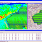
Leica FPES v10.2: New Features for Efficient Planning and Cost-effective Flights

Untitled document

Leica FPES v10.2 offers the most advanced functionality and highest efficiency...

Monday, April 4th, 2011

Korean Railroad to Invest In Indonesia Mass Transport Projects

The Korean Railroad Research Institute (KRRI) is showing interest in working on Indonesia transport infrastructure projects, especially for fast train. One of such project being consider is the mass transportation project linking the Jakarta city center with...

Monday, April 4th, 2011

First Broad-Scale Maps of Life on Australia’s Sea-Shelf

Marine scientists from five research agencies have pooled their skills and resources to compile a directory of life on Australia's continental shelf.They examined the shelf  seascape during a three-year program of the Commonwealth Environment Research Facilities (CERF)...

Monday, April 4th, 2011

Iran to Build Remote Sensing Satellite with APSCO

Iran has said it will build a new remote sensing satellite in cooperation with the Asia-Pacific Space Cooperation Organisation (APSCO) of which it is an active member. The country's space agency chief Hamid Fazeli said Sunday that Iran...

Friday, April 1st, 2011

OpenGeo and GeoCat Join Forces to Revolutionize Web Map Publishing

GeoCat, a geospatial software company specializing in Spatial Data Infrastructure development, and OpenGeo, the world leader in supported open source geospatial solutions, announced that the GeoCat Bridge software will now be available as an integrated component of...

Page 137 of 178 1 132 133 134 135 136 137 138 139 140 141 142 178