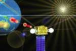

Satellite image analysis will be able to provide information about the lake temperature within the existing crater – Lake Chonji. Land movements and change will also be able to be calculated. A series of 19 broadband earthquake detection networks will also provide information about activity with respect to eruption potential.
As recent research by Asian scientists has pointed out, “…Many active volcanoes are distributing in east Asia, however, most of them are not well monitored. Monitoring volcanoes is a keyissue for disaster mitigation, as well as scientific studies. It is not realistic to install ground-based instruments to all of the activevolcanoes, thus virtually satellite remote sensing is the only way to monitor them scattering in such wide areas.”
At the northern end of New Britain Island in Papua New Guinea, the Rabaul Volcanological Observatory (RVO) is continually monitoring. In this case, several volcanoes have erupted over the years resulting in large numbers of deaths.
“RVO – funded by the Australian Agency for International Development (AusAID) since 1995 after the Rabaul volcano erupted and destroyed most of the town – keeps eight of the country’s most active, high risk volcanos under surveillance using monitoring equipment. It receives daily reports and sends people for closer monitoring if there are reports of unrest.”
There is a real opportunity for remote sensing to play a larger role in the monitoring of volcanic activity throughout the Asia region. If remote sensing activities can quickly monitor these sites and provide even the smallest indications of activity, the costs for supporting them will be readily justified.