Asian Surveying & Mapping
Breaking News
South Korea is converting an abandoned coal mine into a moon exploration testing ground
South Korea is transforming abandoned coal mines into testing...
ISRO to Launch Chandrayaan-5 With Japan, Plans Space Station
Dr. V. Narayanan, Chairman of the Indian Space Research...
Russia and China are threatening SpaceX’s Starlink satellite constellation, new report finds
SpaceX's Starlink satellite constellation is facing threats from Russia...
China and Pakistan agree to fly 1st foreign astronaut to Chinese space station
For the first time, the Chinese space program will train...
ISRO’s “Space on Wheels” offers a peek into Indian Space Programme to students in Karimnagar
The Indian Space Research Organisation (ISRO)’s “Space on Wheels”...
Geospatial led solutions build the foundations for better decision-making
Geo Connect Asia 2025 paves the way for turning...
GEOSA, Singapore Land Authority Launch Achievements of Joint Geospatial System Project
Riyadh, SPA -- The General Authority for Survey and...
Building in Bangkok collapses as powerful earthquake hits southeast Asia
One person has died and 50 were injured in...
Bellatrix Aerospace Partners with Astroscale Japan for Space Debris Removal
Bellatrix Aerospace, a Bengaluru-based space mobility company, has joined...
NSTC announces Pingtung site as Taiwan’s space mission launch center
Taipei, March 26 (CNA) Taiwan's National Science and Technology...
  • Oct 11, 2024
  • Comments Off on High-Tech Solutions Help Prevent Ship Groundings in Coastal Waters 
  • Feature
  • 430 Views

Multiple recent incidents in which naval and commercial vessels ran aground have highlighted the dangers of maritime operations in shallow or poorly charted coastal waters.  

For more than 10 years, TCarta has been supplying marine charting organizations with water depth data using a technique called Satellite Derived Bathymetry (SDB). SDB applies physics-based computer algorithms to optical imagery captured by commercial remote sensing satellites. This analysis detects and measures light reflecting off the seafloor to calculate water depth. Depending on water clarity, SDB is routinely accurate to depths of 20 to 30 meters. 

The off-the-shelf bathymetry product Global Satellite Derived Bathymetry (G-SDB) offers 10-meter detail and is ideal for identifying coastal shoals in remote areas that don’t appear on nautical charts. Large-area contiguous G-SDB products are immediately available for more than a dozen critical locations, including: 

  • South China Sea 
  • Arabian/Persian Gulf 
  • Gulf of Oman 
  • Red Sea 
  • Black Sea 
  • Eastern Mediterranean  

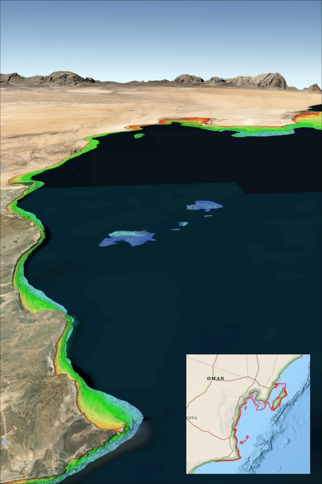
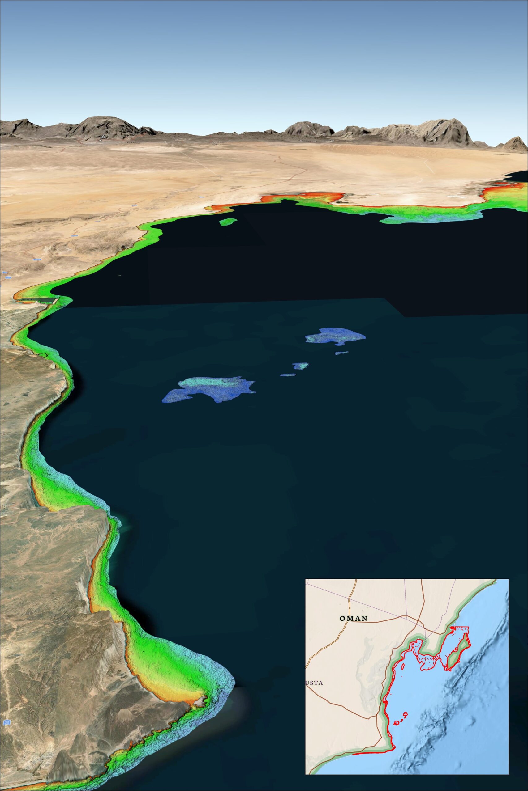
In the accompanying image,  TCarta SDB data on the Oman Coast indicate shallow water depths by color. Red represents 0-3 meters, yellow is 3-6 meters, green is 6-10 meters, turquoise is 10-14 meters, and blue is 14-18 meters deep. Inset map indicates geographic location of dataset. [Credit: TCarta Marine]