Asian Surveying & Mapping
Breaking News
Australia’s Gilmour Space Technologies ready to launch maiden Eris Test flight the nation’s first orbital launch in over 50 years
Gilmour Space Technologies is the leading launch services company...
Korea’s space agency seeks revision of plan to modify next-gen rockets into reusable system
South Korea's aerospace agency said on Thursday that it...
UAE Space Agency Signs Agreement With Technology Innovation Institute to Execute the Emirates Mission to the Asteroid Belt’s Lander Project
In the presence of His Highness Sheikh Hamdan bin...
Private Japanese lunar lander enters orbit around moon ahead of a June touchdown
A private lunar lander from Japan is now circling the moon, with...
Indian astronaut to travel soon to ISS as part of ISRO-NASA Mission
Prime Minister Narendra Modi said by 2040, an Indian’s...
China issues regulatory framework to support direct-to-device satellite services
HELSINKI — China has released comprehensive regulations for direct-to-device...
Astranis clinches $115 million Taiwan deal despite satellite setback
TAMPA, Fla. — Astranis has signed a $115 million...
UAE and Egypt Strengthen Space Collaboration with New MoU
In a milestone development for Arab space collaboration, the...
Seoul launches 4th spy satellite to boost North Korea surveillance
South Korea’s military now operates an increasingly integrated cluster...
Indonesia seeks space defense cooperation with Japan’s military
Jakarta (ANTARA) - The Ministry of Defense of Indonesia...
  • Oct 11, 2024
  • Comments Off on High-Tech Solutions Help Prevent Ship Groundings in Coastal Waters 
  • Feature
  • 454 Views

Multiple recent incidents in which naval and commercial vessels ran aground have highlighted the dangers of maritime operations in shallow or poorly charted coastal waters.  

For more than 10 years, TCarta has been supplying marine charting organizations with water depth data using a technique called Satellite Derived Bathymetry (SDB). SDB applies physics-based computer algorithms to optical imagery captured by commercial remote sensing satellites. This analysis detects and measures light reflecting off the seafloor to calculate water depth. Depending on water clarity, SDB is routinely accurate to depths of 20 to 30 meters. 

The off-the-shelf bathymetry product Global Satellite Derived Bathymetry (G-SDB) offers 10-meter detail and is ideal for identifying coastal shoals in remote areas that don’t appear on nautical charts. Large-area contiguous G-SDB products are immediately available for more than a dozen critical locations, including: 

  • South China Sea 
  • Arabian/Persian Gulf 
  • Gulf of Oman 
  • Red Sea 
  • Black Sea 
  • Eastern Mediterranean  

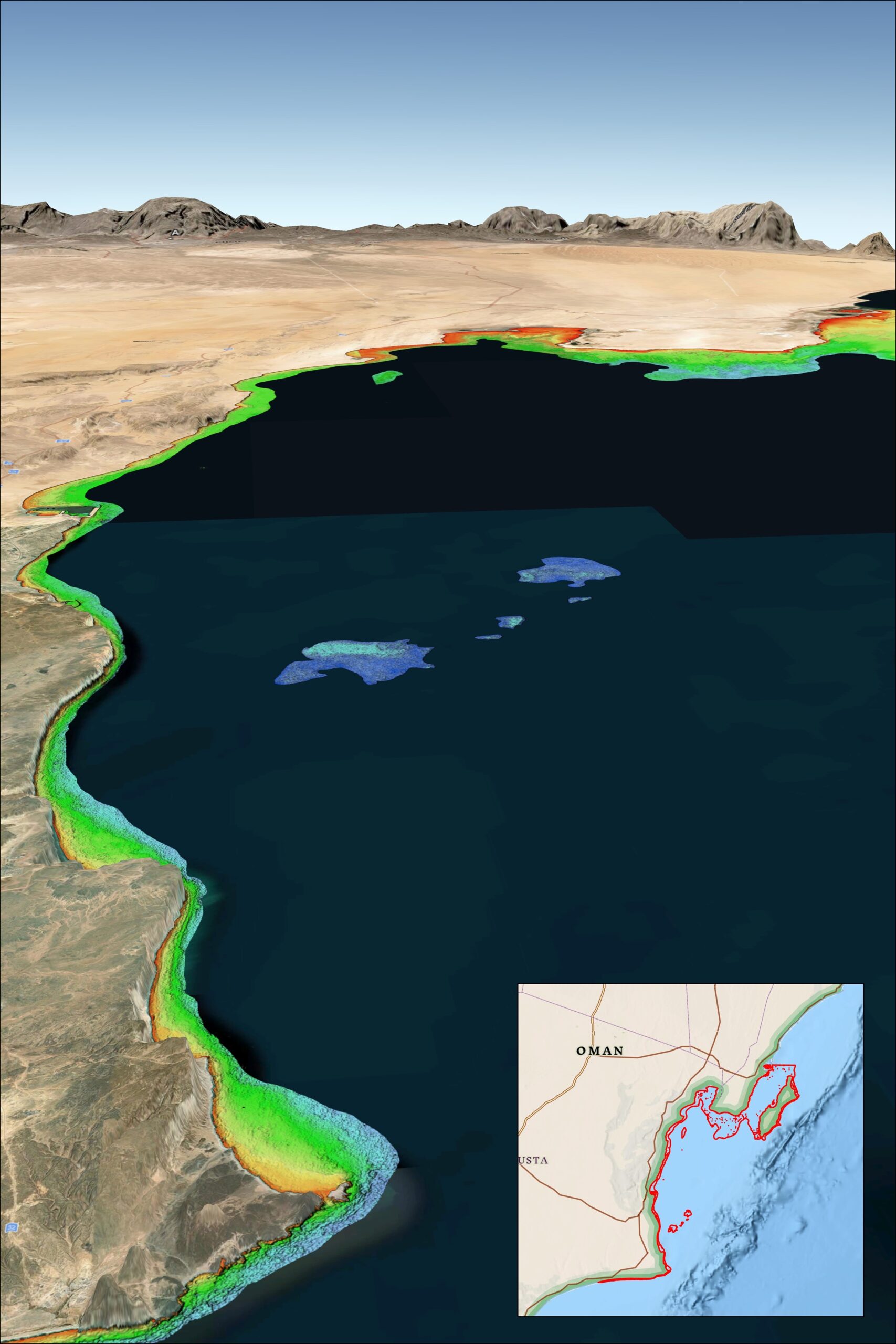
In the accompanying image,  TCarta SDB data on the Oman Coast indicate shallow water depths by color. Red represents 0-3 meters, yellow is 3-6 meters, green is 6-10 meters, turquoise is 10-14 meters, and blue is 14-18 meters deep. Inset map indicates geographic location of dataset. [Credit: TCarta Marine]