Asian Surveying & Mapping
Breaking News
Astranis clinches $115 million Taiwan deal despite satellite setback
TAMPA, Fla. — Astranis has signed a $115 million...
UAE and Egypt Strengthen Space Collaboration with New MoU
In a milestone development for Arab space collaboration, the...
Seoul launches 4th spy satellite to boost North Korea surveillance
South Korea’s military now operates an increasingly integrated cluster...
Indonesia seeks space defense cooperation with Japan’s military
Jakarta (ANTARA) - The Ministry of Defense of Indonesia...
China Launches 3 Astronauts To Its Space Station
The spacecraft Shenzhou-20 and the crew lifted off atop...
Former Isro chairman K Kasturirangan dies in Bengaluru at 84
Dr. Kasturirangan led the Isro, the Space Commission, and...
South Korea is converting an abandoned coal mine into a moon exploration testing ground
South Korea is transforming abandoned coal mines into testing...
ISRO to Launch Chandrayaan-5 With Japan, Plans Space Station
Dr. V. Narayanan, Chairman of the Indian Space Research...
Russia and China are threatening SpaceX’s Starlink satellite constellation, new report finds
SpaceX's Starlink satellite constellation is facing threats from Russia...
China and Pakistan agree to fly 1st foreign astronaut to Chinese space station
For the first time, the Chinese space program will train...

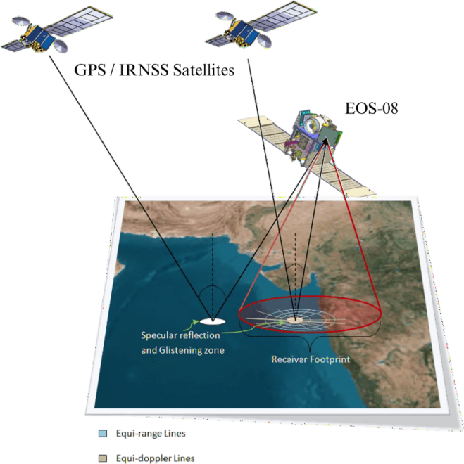
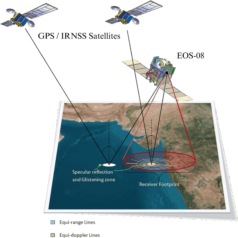
The GNSS-Reflectometry (GNSS-R) instrument on the EOS-08 satellite commenced operations on Aug. 18, 2024. The raw data is being processed at the National Remote Sensing Centre (NRSC-ISRO) in Shadnagar, Hyderabad, using algorithms and data processing software developed by the Space Applications Centre (SAC-ISRO), Ahmedabad. Multiple levels of data products have been successfully generated. 

GNSS-Reflectometry represents a new mode of remote sensing. Signals from Global and Regional Navigation Satellite Systems (GNSS/RNSS), such as GPS and NavIC, are reflected off various Earth surfaces, including oceans, agricultural lands and river bodies. These reflected signals are collected by a precision receiver onboard the satellite (see accompanying figure) as it orbits the Earth at an altitude of 475 kilometers. This measurement system operates without dedicated transmitters and is shallow in resource consumption—requiring minimal size, weight and power. Additionally, it can scale up as a constellation of receivers for faster coverage, making this innovative remote-sensing mode highly useful. 

Image Credit: ISRO