Asian Surveying & Mapping
Breaking News
Ecolab and ITE partners to harness water management knowledge for Singapore data center engineers
SINGAPORE, 29 APRIL 2024 – Nalco Water, an Ecolab...
NASA releases satellite photos of Dubai and Abu Dhabi before and after record flooding
NASA released photos of parts of Dubai and Abu...
Singapore releases 10-year Geospatial Master Plan
Singapore has launched its new Geospatial Master Plan (2024–33),...
Japan announces plans to launch upgraded observation satellites on new flagship rocket’s 3rd flight
TOKYO (AP) — Japan’s space agency announced Friday a...
Tesla China partners with Baidu for maps to clear FSD hurdle
Amidst Elon Musk’s unannounced trip to Beijing, China this...
ESA opens ideas factory to boost space innovation in Austria
A centre to innovate the design and manufacture of...
Japan’s space agency sets June 30 as third launch date for H3 rocket
The Japan Aerospace Exploration Agency (JAXA) announced Friday that...
S. Korea launches nanosatellite for Earth observation
SEOUL- A South Korean nanosatellite was launched into orbit...
Australian Space Agency funds development of aerospace-grade GNSS receiver
The Australian Space Agency has funded the development of...
Continuity risks for Australian EO data access
A new report details the widespread use of Earth...

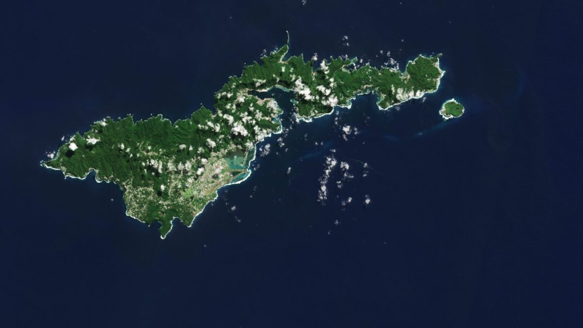
The Copernicus Sentinel-2 mission captured an amazing view of the tropical island of Tutuila, the largest in the American Samoa archipelago in the South Pacific Ocean. 

American Samoa is an unincorporated territory of the United States and is part of the Samoan Islands chain, situated some 4,000 kilometers southwest of Hawaii and about 3,000 kilometers northeast of New Zealand. The eastern part of the chain of islands forms the American Samoa, while the western part forms the independent state of Samoa. 

American Samoa comprises five volcanic islands: Tutuila, Aunu’u, Tau, Ofu and Olosega; and two coral atolls, Rose and Swains. 

Tutuila is a small, narrow island and home to many volcanic mountains. At 653 meters, Mount Matafao, which lies in the centre of the island, is the highest. The mountain range, which cuts across the island, is rugged with steep cliffs dominating the northern part of the island. The south is flatter.  Coral reefs create barriers to the open sea, resulting in lagoons, visible in turquoise, prominent off the southern coast.  

Image Credit: Contains modified Copernicus Sentinel data (2023), processed by ESA