Asian Surveying & Mapping
Breaking News
Esri India Achieves 1 Million Users Milestone
Esri India, the leading provider of Geographic Information System...
Bank Negara, Malaysian Space Agency to bolster financial management ecosystem via space technology
KUALA LUMPUR: Bank Negara Malaysia has partnered with the...
Nepal’s president advisor resigns after criticising inclusion of Indian areas in map on new currency
The economic advisor to Nepal’s president on Sunday (May...
TASA to launch six satellites from 2026
The Taiwan Space Agency (TASA) yesterday said it plans...
Japan to provide flood risk maps for four South-East Asian countries – Indonesia, Vietnam, Thailand and Cambodia
JAKARTA/TOKYO: Japan plans to start providing flood risk maps...
Ecolab and ITE partners to harness water management knowledge for Singapore data center engineers
SINGAPORE, 29 APRIL 2024 – Nalco Water, an Ecolab...
NASA releases satellite photos of Dubai and Abu Dhabi before and after record flooding
NASA released photos of parts of Dubai and Abu...
Singapore releases 10-year Geospatial Master Plan
Singapore has launched its new Geospatial Master Plan (2024–33),...
Japan announces plans to launch upgraded observation satellites on new flagship rocket’s 3rd flight
TOKYO (AP) — Japan’s space agency announced Friday a...
Tesla China partners with Baidu for maps to clear FSD hurdle
Amidst Elon Musk’s unannounced trip to Beijing, China this...

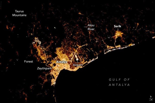
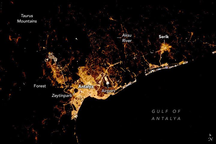
An astronaut aboard the International Space Station took this nighttime photograph of the coastal Mediterranean city of Antalya, Türkiye, in Asia. Located on the southern coast of Türkiye, Antalya is the largest city in this view. The image contrasts brightly lit urban infrastructure against unilluminated parks and natural areas, such as the pentagonal Zeytinpark and surrounding mountain forests. Human-made structures identifiable by lighting patterns include an airport, highways, roads and shipping ports. 

The Taurus Mountains border Antalya to the north and northwest, recognizable in this image as extensive dark areas with small settlements speckled throughout. Agriculture along the Aksu River accounts for the dark space between Antalya and Serik. The Aksu River flows out of the Taurus Mountains, providing water to the community and for irrigating horticulture crops, including tomatoes, peppers and cucumbers. 

Bright lights in white, blue-green and purple hues line the coast between Antalya and Serik. These lights are associated with popular tourist locations like resorts and beaches. White and blue hues often contrast with yellow tones in older cities as bright LED (light-emitting diode) lights replace warm-hued, high-pressure sodium lighting.  

Image Credit: SS Crew Earth Observations Facility and the Earth Science and Remote Sensing Unit, Johnson Space Center