Asian Surveying & Mapping
Breaking News
Ecolab and ITE partners to harness water management knowledge for Singapore data center engineers
SINGAPORE, 29 APRIL 2024 – Nalco Water, an Ecolab...
NASA releases satellite photos of Dubai and Abu Dhabi before and after record flooding
NASA released photos of parts of Dubai and Abu...
Singapore releases 10-year Geospatial Master Plan
Singapore has launched its new Geospatial Master Plan (2024–33),...
Japan announces plans to launch upgraded observation satellites on new flagship rocket’s 3rd flight
TOKYO (AP) — Japan’s space agency announced Friday a...
Tesla China partners with Baidu for maps to clear FSD hurdle
Amidst Elon Musk’s unannounced trip to Beijing, China this...
ESA opens ideas factory to boost space innovation in Austria
A centre to innovate the design and manufacture of...
Japan’s space agency sets June 30 as third launch date for H3 rocket
The Japan Aerospace Exploration Agency (JAXA) announced Friday that...
S. Korea launches nanosatellite for Earth observation
SEOUL- A South Korean nanosatellite was launched into orbit...
Australian Space Agency funds development of aerospace-grade GNSS receiver
The Australian Space Agency has funded the development of...
Continuity risks for Australian EO data access
A new report details the widespread use of Earth...
sea ice_measurement

Scientists from JPL and NASA tell us that, “thickness of Arctic sea ice plays a critical role in Earth’s climate and ocean circulation. An accurate measurement of this parameter on synoptic scales at regular intervals would enable characterization of this important component for the understanding of ocean circulation and the global heat balance.”

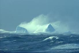
CryoSAT, an ice measuring satellite was launched for the purpose of monitoring ice. Its Synthetic Aperture Interferometric Radar Altimeter (SIRAL) sensor is capable of measuring freeboard ice. 

Last week Spot 4 images were analyzed by ScanEx, a Russia remote sensing company, for the purpose of monitoring and identifying sea ice in the western Pacific Ocean.  The Australian Government monitors sea ice levels in the Antarctic as well.  Japan expects to launch a new satellite in fall 2012 that  will measure sea ice levels. While Arctic ice levels have decreased rapidly over time, Antarctic ice levels appear to have remained stable. Some have speculated that the Antarctic ice levels are increasing

Today, satellites are monitoring ice pack heights daily and providing up-to-date information. It is anticipated that these data will help to provide data and support to global modeling initiatives involving climate systems and global ocean circulation.